Kentucky Flooding: A State That Keeps Running Out of Time to Recover
Governor Andy Beshear didn't mince words after the flooding that hit Kentucky in late June 2026. He called it the state's 16th weather-related disaster in roughly six and a half years. Rescue crews carried out more than 60 water rescues after parts of the state got up to 8 inches of rain in a single weekend, and at least four people died. A flood watch is active across nine eastern Kentucky counties as of mid-August 2026. This article covers why Kentucky keeps getting hit so often, what makes Appalachian terrain especially dangerous during heavy rain, what's flooding right now, and how rural mountain communities need to prepare differently than flatter parts of the country.
A State That Keeps Running Out of Recovery Time
The June flooding was more than another bad storm. Beshear said it was the state's 16th weather-related disaster in six and a half years. Dozens of water rescues and evacuations had already taken place, while flooding left roads impassable and damaged homes and infrastructure.
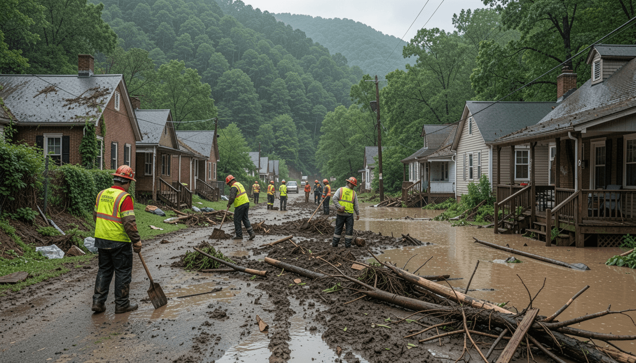
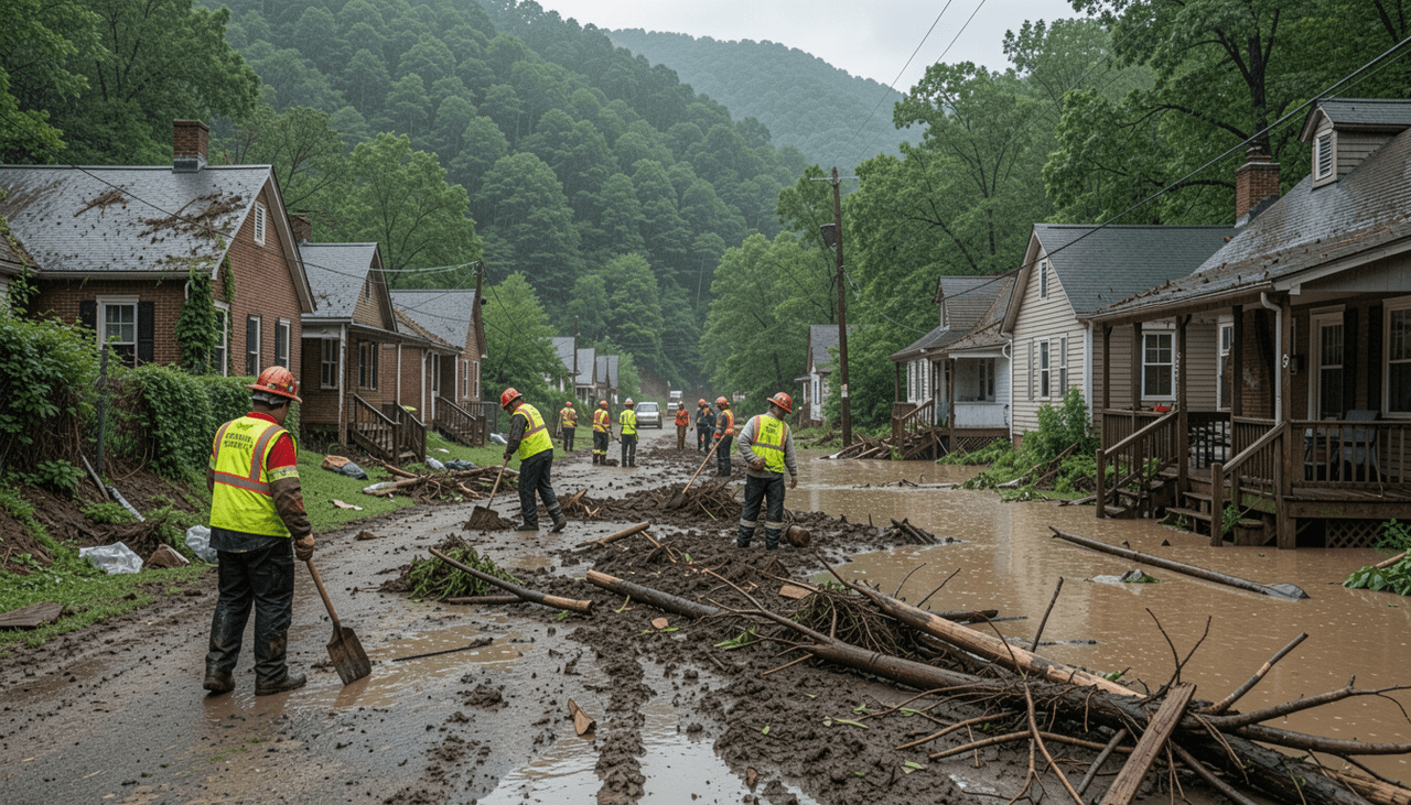
The frequency is easier to understand when viewed against the disasters that came before it. The 2022 Appalachian floods killed at least 39 people directly in eastern Kentucky, with additional deaths associated with cleanup efforts, and caused an estimated up to $950 million in damage. More than 33,000 electricity customers lost power during the disaster, while washed-out roads and bridges left some rural communities isolated.
Recovery can stretch for months or years after an event of that scale. Then another flood arrives, bringing new damage before every damaged road, home and utility connection has been restored.
Groups like Kentucky Baptist Disaster Relief and Matthew 25: Ministries have become recurring responders rather than one-time volunteers, since mud-out cleanup work has become a near-annual need in some counties. Shelters and cleanup crews increasingly lean on portable solar panels for power when the grid and fuel supply chains both go down at once, since sunlight doesn't run out the way diesel does.
With disasters arriving this close together, the practical planning question shifts from "if" to "how long until help can reach you this time." That starts with power.
Planning for Power in Places Crews Can't Reach Quickly
Kentucky's worst flooding tends to hit rural, mountainous counties where washed out roads and landslides can delay utility crews and emergency responders for days, not hours. The June 2026 storms even triggered a landslide at a dam embankment in Bullitt County, though officials confirmed the dam held with no sign of failure.
When local access routes fail, standard restoration timelines break down, requiring households to rely on self-sufficient backup energy during long periods of isolation. Setting up the best off-grid power for rural homes and remote land addresses this specific planning gap before outages hit. Safe operation is critical in flooded areas
Never run a fuel powered generator indoors, in a garage, or near a home that's taken on any water. Combining exhaust fumes with flood conditions is dangerous on its own.
EcoFlow DELTA Pro Ultra X
EcoFlow DELTA 3 Ultra Plus (3,072 Wh)
EcoFlow DELTA Pro 3
With power planning covered, here's the terrain factor that makes Kentucky's flooding uniquely dangerous compared to flatter parts of the country.
Why Appalachian Terrain Turns Rain Into Rapid, Compounding Danger
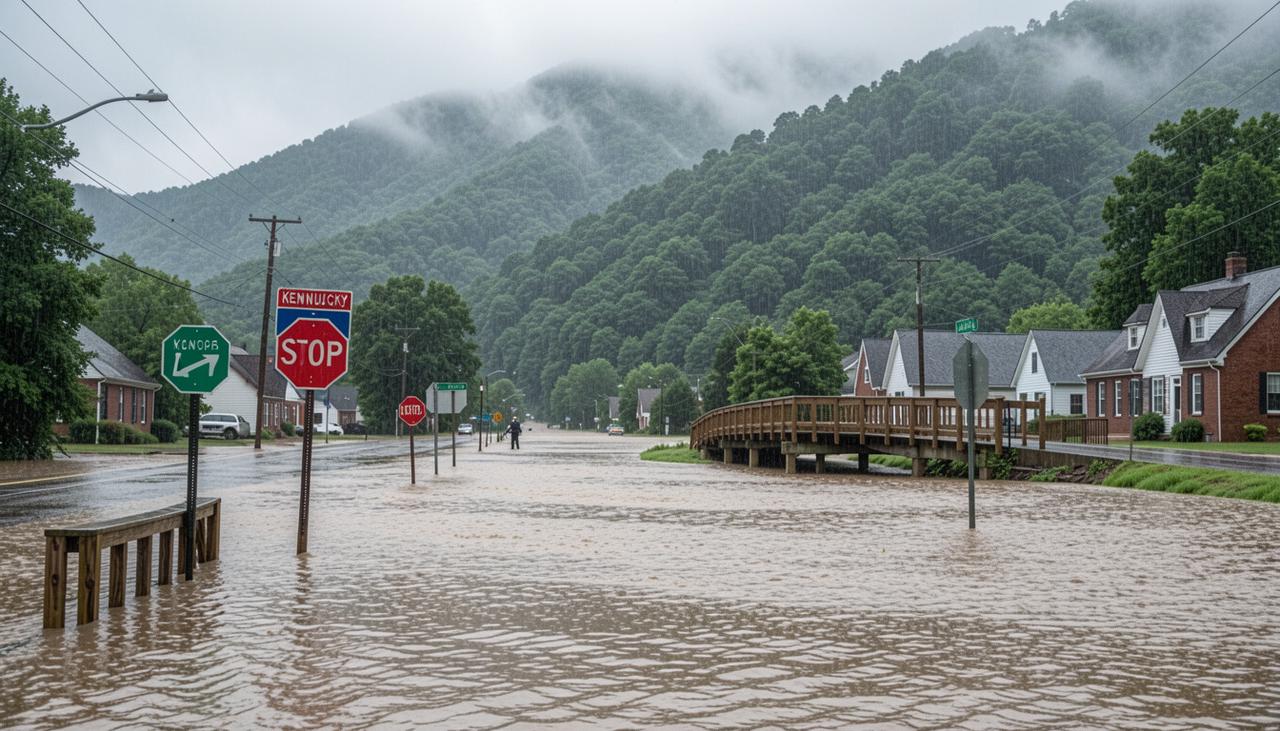
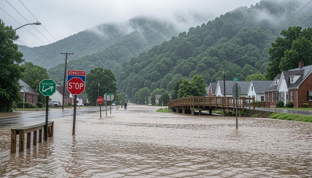
Eastern Kentucky's steep hollows and narrow valleys force rainfall to gather and race downhill far faster than it does on flat ground. Water that would spread out and soak in elsewhere funnels straight into creeks and streams. That is why 8 to 12 inches of rain in 48 hours can turn ordinary channels into walls of water strong enough to tear out roads, bridges, and entire stretches of a community.
Most of the towns and houses in the region sit along those same creek bottoms. In the mountains, the only reasonably flat, buildable land has always been right next to the water. Generations of settlement followed that pattern, so more homes, churches, and businesses end up sitting directly in the path of water that rises with almost no warning.
The June 2026 storms showed how the risk multiplies. Heavy rain triggered a landslide that took out part of a dam embankment. The dam itself held, but the slope failure still forced evacuations and closed roads. In this terrain, flooding is rarely the only problem. Saturated hillsides can give way days after the rain stops, cutting off the same communities that just went underwater.
The combination is what makes these events so hard to recover from. Fast water, homes built on the only available flat ground, and the constant chance of landslides leave little margin. When the next storm arrives before the last mud is even cleared, the cycle starts again with less time and fewer open roads.
With that terrain risk in mind, here's what's actually happening on the ground as of this writing.
What's Flooding in Kentucky Right Now
As of mid-August 2026, a flood watch covers a string of eastern Kentucky counties that includes Elliott, Fleming, Rowan, Johnson, Martin, Floyd, Magoffin, Morgan, and Pike. Heavy rain is still falling in rounds, and the ground remains soaked from earlier storms, so flash-flood risk stays high even when the radar looks quiet for a few hours.
The June 2026 event that set this cycle in motion was broader. More than a dozen counties and cities declared states of emergency: Albany, Brandenburg, Burkesville, McKee, Muldraugh, Bullitt, Clinton, Cumberland, Garrard, Grayson, Jackson, Jessamine, Madison, Meade, Mercer, Metcalfe, Spencer, and Wayne. Up to eight inches of rain fell in places, water rescues topped sixty, and at least four people died. Roads washed out, bridges closed, and some communities were cut off for days.
That kind of saturation does not clear quickly in the mountains. Hillsides that have already taken a soaking can release more water and mud with only modest additional rain. Landslides and renewed flooding often show up days after the main storm has moved on, which is why a new watch can appear while people are still cleaning out basements from the last one.
Because watches, warnings, and affected county boundaries change rapidly, check the latest live updates directly from the National Weather Service offices serving eastern and central Kentucky at NWS Jackson and NWS Louisville before relying on specific locations or timing.
As this pattern keeps repeating, a few safety habits that fit mountains and hollow life matter more here than they do in a flatter country.
Flood Safety for Mountain and Hollow Communities
Flood safety in Kentucky's mountain communities starts with the terrain itself, the real chance of isolation, and ways to keep receiving warnings when the usual systems fail.


Know your elevation
Map how your house sits relative to the nearest creeks, streams, or hollows. Flash flooding upstream can send water toward creek-bottom homes with little warning, even when rainfall near the property seems manageable.
Keep an emergency radio
Keep a battery-powered or hand-crank radio available because cell service, internet, and electricity can fail when rural infrastructure is damaged. A radio provides another way to receive weather alerts and emergency information.
Prepare to shelter in place
If flooding washes out a road or a landslide blocks access, be prepared to remain at home for several days. Do not assume an evacuation route will remain open throughout the storm or its aftermath.
Plan for power outages
Flooding can damage utility lines, equipment, and access routes, making outages last longer. Understanding power outages can help households prepare essential devices and backup power before the next storm.
Conclusion
Kentucky has faced 16 federally significant weather disasters in roughly six and a half years. In the mountains, heavy rain turns into fast flooding, landslides, and isolation quicker than it does on flat ground. Know how your house sits relative to the nearest creek or hollow. Plan for the chance that roads will stay closed for days. Keep backup power ready for outages that can stretch well past a normal restoration window.
The EcoFlow DELTA Pro Ultra X, DELTA 3 Ultra Plus, and DELTA Pro 3 cover whole-home and fast-charging portable needs for exactly these conditions.
FAQs
Why has Kentucky faced so many weather disasters in recent years?
Governor Beshear has counted 16 weather-related disasters in about six and a half years. Frequent heavy-rain events combined with steep Appalachian terrain produce repeated flooding, landslides, and damage that leave little recovery time between storms.
What areas of Kentucky are currently under flood watch?
Flood watches change quickly as weather conditions develop. Earlier August alerts included Elliott, Fleming, Rowan, Johnson, Martin, Floyd, Magoffin, Morgan, and Pike counties. Residents should check current alerts before traveling or making safety decisions.
Why does Appalachian terrain make flooding more dangerous?
Eastern Kentucky's steep hills, narrow valleys, and hollows can channel heavy rainfall rapidly into creeks and streams. Homes and roads built along valley floors can then face fast-rising water, while landslides and damaged bridges can make evacuation and emergency response more difficult.
How long can rural Kentucky communities be without power after a flood?
Washed-out roads and landslides can keep utility crews out for days. Restoration depends on damaged or unreachable infrastructure, so outages often last well past the typical window seen in more accessible areas.
Can a battery backup system keep essentials running during an extended flood-related outage?
Yes. High-capacity, fumeless battery systems like the EcoFlow DELTA Pro Ultra or DELTA Pro 3 safely run critical indoor essentials such as medical equipment, refrigeration, and sump pumps, recharging via solar panels when flooded roads isolate rural areas.
For press requests or interview opportunities, reach out to our media team
media.na@ecoflow.com