What Is Freezing Rain? Formation & Impacts
The street can look wet when it is anything but. Sometimes the first clue is a shine on the mailbox, a stiff windshield wiper, or a dog that loses its footing on the back step. Freezing rain does not arrive with the obvious buildup of a snowstorm. It falls as rain and leaves the ice behind.
That thin glaze is enough to turn a routine drive into a dangerous one. If the rain continues, the problem moves overhead as ice weighs down limbs, wires, and service connections. Understanding the setup helps explain why one town gets cold rain while another, only a few miles away, ends up coated in ice.
What Is Freezing Rain and How Does It Form?
Freezing rain is liquid rain that freezes after landing on a surface at or below 32°F, which is the basic freezing rain definition used to distinguish it from other forms of winter precipitation. The drops are often supercooled. In other words, they cool below the normal freezing point but remain liquid while falling. Because freezing rain can contribute to power outages, homeowners in affected areas may want to keep a portable power station ready for essential devices.
Most freezing rain begins as snow higher in the cloud. The flakes pass through a layer of warmer air and melt. Near the ground, they enter cold air again, but this lower layer is shallow. The drops have enough time to become very cold, but not enough time to freeze into ice pellets.
Then they hit something.
A railing, branch, road sign, power line, or car roof provides the surface the water needs to freeze. Elevated objects often glaze before the center of a busy road does. Bridges and untreated side streets can follow quickly. Each additional drop spreads over the ice already there, leaving the hard, smooth coating known as glaze.
The temperature shown in a weather app does not tell the whole story. A reading of 33°F at the airport does not guarantee every bridge deck or shaded driveway is above freezing. This is why the question at what temp does rain freeze has a more nuanced answer than simply looking for an air temperature of 32°F. Surfaces cool at different rates, and pockets of colder air can settle into low spots.
Freezing Rain vs. Other Winter Precipitation
The names are easy to mix up because a single storm may bring all four types, so understanding what is frozen rain comes down to knowing what happens between the cloud and the ground.
Feature | Freezing Rain | Sleet (Ice Pellets) | Snow | Freezing Fog / Rime Ice |
State When Falling | Liquid droplets | Small frozen pellets | Ice crystals | Tiny supercooled fog droplets |
How It Forms | Snow melts, then stays liquid in a shallow cold layer | Rain refreezes before reaching the ground | Ice crystals stay frozen through the air column | Fog droplets freeze onto cold surfaces |
Resulting Surface | Smooth, clear glaze ice | Loose, gritty ice pellets | Soft or packed snow | White, rough frost |
Main Hazard | Severe road ice, tree damage, power outages | Slick roads and reduced traction | Snow-covered roads and low visibility | Ice buildup on exposed surfaces |
Sleet usually makes itself heard as it taps against a window and bounces on the pavement. Freezing rain sounds like rain. That quiet difference matters because drivers may see a dark road and assume it is merely wet.
Freezing fog is another surface-icing problem, though it develops from fog droplets close to the ground rather than rain falling through a warm layer. The deposit is often rougher and whiter than clear glaze. Conditions may change during the storm, so yesterday’s sleet forecast isn’t a reason to ignore freezing rain outside the window.
Where and When Does Freezing Rain Occur?
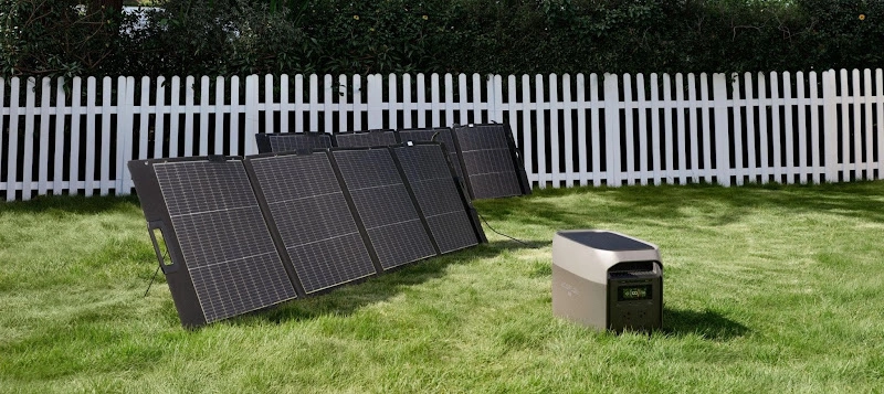
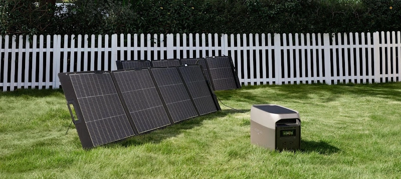
Any region with winter cold can get freezing rain, but some landscapes hold the necessary cold air more easily. In areas prone to ice-related outages, keeping a power station available can provide backup electricity for essential household devices. Valleys, mountain barriers, and familiar storm tracks all play a part.
U.S. Regions Prone to Freezing Rain
The Appalachian Corridor and Mid-Atlantic: Cold air sometimes becomes wedged against the eastern slopes of the Appalachians. Warmer, moisture-filled air slides over it. The Virginia and Carolina Piedmont can stay below freezing at ground level after areas farther west or nearer the coast have changed to plain rain.
The Midwest and Ohio River Valley: Storms coming out of the Plains often pull Gulf moisture over a shallow pool of cold air. Missouri may be dealing with ice while Ohio is still waiting for precipitation, and the dividing line between rain, sleet, and snow can move for hours.
The Pacific Northwest and Columbia River Gorge: Cold continental air east of the Cascades can spill west through the gorge and settle around Portland and Vancouver. Pacific moisture arrives above it. The coast may get an ordinary rainy day while the gorge and nearby lowlands ice over.
The Northeast and New England: Interior valleys are good at holding cold air beneath incoming warmth. Elevation matters, as does distance from the coast. Two communities separated by one ridge may report entirely different conditions.
The list is not exclusive. Oklahoma, Arkansas, north Texas, Tennessee, and other parts of the southern Plains and South have all dealt with damaging ice. Heavy snow does not have to be common for freezing rain to cause trouble.
Seasonal Patterns of Freezing Rain
Late fall through early spring is the usual window. In much of the central and eastern United States, most events fall between November and March. The edges of that season are flexible. An early Arctic push can produce October ice, and a sheltered valley may still freeze during a spring storm.
Timing within the storm is more useful than the month on the calendar. A forecast may call for two hours of freezing rain at the beginning, followed by ordinary rain once the ground-level cold air finally gives way. Another storm may start as snow, change to sleet overnight, and leave glaze near sunrise.
Ice does not disappear the minute rain ends. Open pavement may improve under afternoon sun while a shaded front walk stays slick. Refreezing after sunset can undo some of the day’s progress.
Weather Conditions That Increase the Risk of Freezing Rain
Forecasters study a vertical profile of the atmosphere. The surface temperature is only the bottom line of that profile. A typical freezing-rain setup has:
Cold, dense air close to the ground, sometimes trapped by terrain or supplied by high pressure to the north.
A layer of above-freezing air aloft that melts falling snow.
Moisture arriving before the shallow surface cold has been pushed away.
A small temperature change can alter the outcome. Make the lower cold layer deeper and the drops may refreeze into sleet. Remove the warm layer aloft and the snow never melts. Warm the surface enough and the precipitation becomes rain, although ice already on roads may take longer to release.
The recent weather matters too. Pavements that have spent two days in the 20s can glaze almost immediately. After a mild afternoon, a heavily traveled road may stay wet for a while even as the deck, parked cars, and bridge railings turn white or glassy.
What Impacts Can Freezing Rain Have?
Ice accumulation is measured in fractions of an inch, which can make the forecast sound minor. It is not. A thin coating removes traction; a thicker one begins loading every exposed branch and wire. Add wind, and damage can spread after the rain has stopped. These hazards make how to prepare for an ice storm a practical consideration before freezing rain arrives.
Effects on Roads and Travel
The most dangerous ice is often the least dramatic to look at. Clear glaze preserves the dark color of the pavement beneath it. A driver may not recognize the change until the steering feels light or the car ahead begins to slide. The differences between freezing rain and sleet can also help explain why road conditions may change so quickly during a winter storm.
Bridges and overpasses are common early trouble spots because cold air reaches both sides of the deck. Watch ramps, shaded curves, hills, parking-lot entrances, and untreated neighborhood roads as well. A main highway can be passable while the final half-mile home is not.
All-wheel drive helps a vehicle get moving. It does not shorten the stop on glare ice. The same is true of a heavy SUV or pickup. Winter tires improve grip, but no tire turns freezing rain into safe driving weather.
Travel problems do not end with cars. Sidewalks become difficult for anyone with limited balance or mobility. Airport operations slow for deicing, rail switches may freeze, and buses can be delayed or canceled. Staying home leaves road space for salt trucks, utility crews, ambulances, and firefighters.
Damage to Trees and Power Lines
Glaze forms around a branch rather than lying lightly on top of it. The added weight is spread along every twig and limb. Weak forks and old damage often give way first, though healthy trees can break when ice becomes thick enough.
Evergreens catch ice across thousands of needles. Trees that still hold leaves have more surface area too. Once a crown is loaded, even a modest breeze can finish what the ice started.
Do not stand below a bowed limb to inspect it, and do not beat the ice off with a rake. A branch may split, spring upward, or dump its load at once. If it is near a utility line, leave it to the utility or a qualified tree professional.
Power Outages and Electrical Disruptions
An ice storm rarely creates one tidy break. A branch may pull down the service to a single house while several miles away a damaged pole takes out an entire circuit. Transformers, crossarms, communications cables, and road access can all become part of the repair.
Crews face the same slick streets everyone else does. They may also need tree teams ahead of them before a bucket truck can reach the line. As thawing begins, newly released limbs can cause another round of outages.
Fuel-burning heat may stop with the electricity. A modern gas or oil furnace needs power for its controls, ignition, and blower. Many boilers rely on circulator pumps, and pellet stoves need their augers and fans. Check the actual electrical requirements rather than assuming the fuel alone will keep the house warm.
How Can You Stay Safe During Freezing Rain?
Do the ordinary jobs while the porch is still dry. Once the glaze forms, bringing in firewood, moving a car, or checking a gutter is no longer routine.
Check Weather Alerts and Road Conditions
Open the National Weather Service point forecast for your address and read past the weather icon. Look for the expected start time, the changeover time, and the amount of ice.
A few hundredths of an inch can disrupt travel. Greater accumulation raises the concern for trees and power lines.
A Winter Weather Advisory generally means hazardous conditions are expected. An Ice Storm Warning points to damaging ice accumulation that is occurring or likely. Local National Weather Service offices set their own thresholds, so read the notice issued for your county.
Before driving, open the state Department of Transportation’s 511 map. Cameras and closure reports may show a very different picture from the street outside. Also turn on utility alerts. Restoration times often change once crews see the damage.
Keep another way to receive information. A battery-powered NOAA Weather Radio still works when the home router is down, and cellular networks are overloaded.
Prepare Emergency Supplies and Backup Power
Start with a dark-house test: if the power failed tonight, could you find the flashlight without using your phone? Put lights, batteries, medication, blankets, water, ready-to-eat food, pet supplies, and a manual can opener where everyone can reach them.
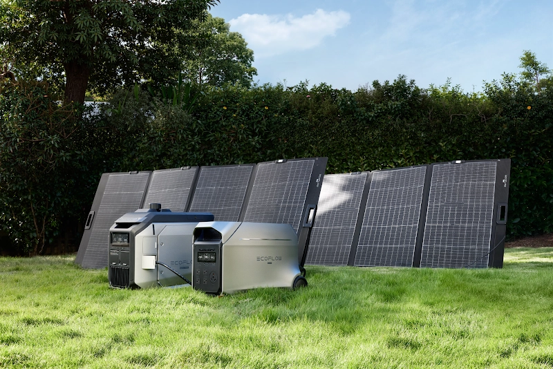
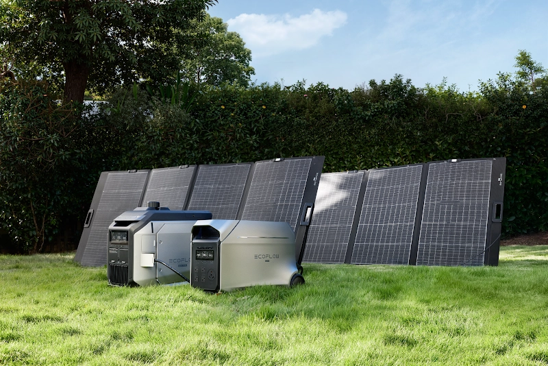
Charge phones, lanterns, power banks, and backup batteries early. Then write a short list of the equipment that truly needs electricity. A refrigerator, router, medical device, and a few lamps are easier to plan for than a vague goal of powering everything.
Read the labels. Refrigerators and other motor-driven appliances can draw more power when starting than while running. For essential loads, the EcoFlow DELTA 3 Max Portable Power Station provides 2,048Wh of capacity. Runtime changes with the connected load, conversion losses, temperature, battery condition, and how often an appliance cycles.
Try the intended setup on a normal day. Make sure every cord reaches, the refrigerator starts, and nobody has to place the unit beside a wet doorway. Keep a battery power station indoors, dry, and clear around its vents.
Stay Safe on Icy Roads and During Travel
If the rain is freezing, postponing the trip is the sensible choice. Treatment takes time, and a road labeled “open” is not necessarily clear from end to end.
When travel cannot wait, reduce speed before the vehicle reaches ice. Leave an unusually large gap ahead. Brake, steer, and accelerate gently, and leave cruise control off. If the car starts sliding, ease off the accelerator and avoid a sudden correction.
The trunk should hold more than an ice scraper. Pack a blanket, warm layers, water, a flashlight, a charged power bank, and basic first-aid supplies. Clear the whole windshield and all exterior lights before moving.
Walking calls for patience too. Take short steps, use a treated route, and keep your hands out of your pockets so you can balance. Painted curbs, porch steps, and parking-lot stripes can be surprisingly slick.
Keep Essential Devices Running During a Power Outage
Once utility power is gone, stop treating every outlet as equally important. Refrigeration, medical equipment, communication, and safe lighting usually come first. Turn off unused devices and avoid spending battery capacity on resistance heaters unless the system was sized for that load.
The EcoFlow DELTA 3 Ultra Plus Portable Power Station has 3,072Wh of capacity and app-based controls for checking output and remaining charge. It can support compatible household essentials within its limits, but the battery does not create unlimited runtime. A 1,500W portable heater can consume stored energy far faster than a router, lamp, or refrigerator that cycles.
Plug devices directly into the power station with intact cords placed out of walking paths. Never use a double-male cord or connect the unit to a wall receptacle to energize household wiring. Hardwired circuits need compatible transfer equipment and, where required, an electrician.
An engine-driven generator is a different machine with a different risk. Run it outdoors, at least 20 feet from doors, windows, and vents, with exhaust directed away from the building. A garage is not safe, even with the door raised. Neither is a shed, basement, or enclosed porch.
Avoid Dangerous Roads and Downed Power Lines
Blue sky after the storm can be misleading. Ice begins sliding from roof edges, and branches shift as the load melts unevenly. Give trees, eaves, and utility equipment plenty of room.
Assume every fallen wire is live. Stay at least 35 feet away, keep other people back, and call 911 and the electric utility. Electricity may travel through wet pavement, pooled water, fences, branches, or a vehicle touching the line. Do not drive across it or try to lift it with an object.
If a wire lands on a vehicle, occupants should normally remain inside and call 911. Leave only when there is an immediate danger such as fire, and follow the dispatcher’s directions. Touching the car and ground at the same time can create a path for current.
Conclusion
Freezing rain rarely announces itself with a dramatic change in the view. The road stays dark, rain ticks against the window, and the ice quietly thickens. That is exactly why it causes so many problems.
Use the forecast window. Finish travel, bring supplies inside, charge the backup equipment, and move vehicles away from questionable limbs. Once icing begins, stay off untreated roads and out from under trees and roof edges. The safest response is usually the least exciting one: remain indoors, conserve power, and give road and utility crews time to work.
FAQ
What Situation Would Most Likely Result in Freezing Rain?
A deep layer of warm air aloft hovering above a shallow subfreezing layer at ground level creates the textbook environment for freezing rain. As high-altitude snow falls through this elevated warm wedge, it melts into liquid raindrops, which then become supercooled as they pass through the thin, sub-freezing layer near the ground and freeze upon impact with cold surfaces.
Is Freezing Rain Common in the U.S.?
Yes, freezing rain occurs frequently across large parts of the United States, especially throughout the Midwest, the Appalachian valleys, the Mid-Atlantic, and the Columbia River Gorge. Many of these regions experience between two and six distinct freezing rain days every winter.
What Time of Day Are Roads Most Icy?
Roads are typically most treacherous during the pre-dawn hours and early morning, between 4:00 AM and 8:00 AM. Ground temperatures reach their absolute diurnal minimum during this window after radiating heat into space all night long, preventing any solar warming from melting surface glaze.
How Long Can a Portable Power Station Run?
Run time depends directly on the watt-hour capacity of the power station and the total wattage of the appliances you plug into it. For example, a 2048Wh unit can comfortably power an efficient full-size refrigerator (drawing around 100-150W cyclically) along with home Wi-Fi and phone chargers for anywhere from 18 to 36 hours before needing a recharge.
What Is the Best Way to Store a Portable Power Station?
Store your portable power station in a dry, climate-controlled space held between 50°F and 77°F with its battery level charged to approximately 60% to 80%. When bracing for an incoming winter storm, however, you should top it up to 100% capacity so you have maximum backup energy on hand if the electrical grid goes down.
For press requests or interview opportunities, reach out to our media team
media.na@ecoflow.com