Polar Vortex Forecast: What to Expect for Winter 2026–2027
A winter labeled “warmer than normal” can still contain a miserable week of frozen pipes and stalled cars. Seasonal outlooks average three months; they do not describe every day within them.
That is worth remembering whenever the polar vortex starts appearing in headlines. As of September 2026, El Niño is strengthening, and NOAA expects it to have a major influence on the coming winter. The broad outlook leans warmer across much of the northern United States and wetter across a large part of the South and central U.S.
None of that tells us when the coldest week will arrive. A polar vortex disruption cannot be placed on the calendar months beforehand. The seasonal outlook supplies the direction; local forecasts will eventually provide the useful details.
What Is a Polar Vortex?
The polar vortex is part of the Arctic’s circulation, not a storm traveling across a weather map. It remains around the poles year-round and grows stronger during winter.
Talk of a vortex “split” usually concerns the stratosphere, well above everyday weather. A change there may influence the jet stream later, but it does not create an immediate cold wave.
When the circulation is strong and fairly compact, much of the coldest Arctic air tends to remain farther north. When it weakens or moves away from the pole, the jet stream may develop deeper bends. One of those southward dips can open the door for Arctic air to reach the United States.
A shift does not automatically mean an American cold wave. Europe or Asia may bear the brunt, and U.S. outbreaks can occur without a dramatic split. For protecting pipes or postponing a drive, the local forecast is what matters.
What Does the Polar Vortex Forecast Show for Winter 2026–2027?
A polar vortex 2026 forecast cannot credibly show which cities will experience an outbreak months from now. The strongest signal heading into winter 2026–2027 is El Niño. NOAA reported in September that it was strengthening, with a greater than 90% chance of becoming very strong during fall and winter.
That changes the seasonal odds, not the route of every storm. Even an area marked “equal chances” may have an eventful winter; forecasters simply lack a strong tilt toward one temperature or precipitation category.
ENSO Signals and the Winter Jet Stream Outlook
El Niño is the warm phase of the El Niño–Southern Oscillation, or ENSO. During many El Niño winters, the southern jet stream becomes more active, sending storms across California, the Southwest, the southern Plains, the Gulf Coast, and the Southeast.
The northern U.S. often finishes the season on the mild side. “Often” matters: past El Niño winters have not all looked alike, and patterns over the North Pacific, Arctic, and Atlantic can take control for days or weeks.
How El Niño May Influence Winter Weather
A seasonal map shows probability. A wetter southern winter may bring steady rain to one state, mountain snow to another, and ice where shallow cold air becomes trapped near the ground. The outlook cannot sort out those details this early.
El Niño does not prevent northern cold, either. A city can endure a sharp Arctic outbreak and still finish the three-month season warmer than normal. Likewise, a few large storms may account for most of a wetter-than-normal seasonal total.
Much of the U.S. Is Favored to Be Warmer
NOAA’s temperature map leans warm across a broad northern belt, including parts of the interior Northwest, northern Plains, Upper Midwest, and Northeast. Many areas west of the Rockies are included too.
That shading does not rule out snow or a hard freeze. It refers to the three-month average, so a bitter week can sit between long mild stretches and barely show up in the seasonal number.
The map cannot predict one home’s heating bill, either. Insulation, equipment condition, thermostat use, and electricity rates may matter as much as the weather.
Because ice and wind can interrupt power outside the coldest region, a home battery can keep selected compatible loads available during an outage.
The South and Central U.S. Are Favored to Be Wetter
On the precipitation map, wetter odds run from parts of California and the Southwest through the southern Plains, Gulf Coast, Southeast, and sections of the Atlantic Coast.
That describes a seasonal total, not the next storm. Near the Gulf, much of the moisture may be rain. Farther north, shallow cold air could turn the same system into sleet or freezing rain, and that boundary may move until the final hours. In the West, valley rain may become heavy snow at pass level.
Why Polar Vortex Disruptions Defy Seasonal Outbreaks
At times, large atmospheric waves disturb the circulation above the Arctic. Stratospheric temperatures rise quickly, the usual winds slow or reverse, and the vortex may shift away from the pole or break apart. This is sudden stratospheric warming.
These events cannot be timed reliably an entire season ahead. Even after one appears in a shorter-range forecast, it does not push Arctic air directly toward a chosen destination. The surface response may take time, develop elsewhere in the Northern Hemisphere, or remain limited.
There is no universal date for when the polar vortex will end; stratospheric recovery and a local cold spell can follow different timelines.
This is why a national headline about a “collapsing polar vortex” should not be treated as a local weather warning. The useful question is not whether the vortex is disturbed. It is whether reliable forecasts show the cold reaching your area, how long it may remain, and what hazards are expected with it.
What Winter Weather Conditions Could Develop in 2026–2027?
Several kinds of winter weather remain possible. Their location and timing will depend on storms that have not developed yet.
Extreme Cold and Arctic Outbreaks
The most disruptive cold does not always occur where temperatures are lowest. It often occurs where buildings, plumbing, roads, and power systems are less prepared for a prolonged freeze.
Rain followed by a steep temperature drop is a particularly troublesome setup. Pavements that looked wet at dinner may be frozen by bedtime. Plumbing in an outside wall may freeze over several hours, with a crack appearing only after the thaw. Wind makes the cold harder on exposed skin.
Look beyond the single lowest number. A cold morning followed by a thaw is one problem; three days below 32°F are another. The longer event gives the house, battery, and water lines little chance to recover.
Heavy Snow and Snowstorms
Snow becomes possible when a moisture-rich storm meets air cold enough to keep flakes from melting. The deciding factor is often where that cold air settles. Nearby towns can end up with rain, slush, or several inches of snow.
Forecast totals make headlines, but snowfall rate often determines how quickly travel goes bad. Two inches in an hour is different from two inches across an afternoon. Wind can refill a plowed road, while wet snow may pull down branches. Check the timing instead of focusing on one number in an app.
Freezing Rain and Ice Accumulation
Freezing rain requires warm air above a shallow layer of cold air. Falling snow melts, remains liquid near the ground, and freezes when it strikes a road, branch, car, or power line.
The first warning may be a shine on a porch rail or a windshield icing over again. Bridges, ramps, and untreated streets become hazardous early, while the pavement may still look wet.
As a rough guide, National Weather Service ice accumulation threat categories show how impacts can increase as ice builds up:
Less than 0.25 inches can make pavement hazardous.
Around 0.25 to 0.50 inches of ice may begin breaking smaller branches and causing power outages.
Accumulations near or above 0.50 inches or more raise the risk of extensive tree and utility damage.
Those are not hard cutoffs. A quarter inch of ice accompanied by gusty wind may do more damage than a thicker coating during calm weather. Tree condition, soil moisture, and the type of ice also affect what breaks.
Strong Winds and Winter Storms
A deep winter storm may produce strong wind well beyond the area receiving the most snow. Gusts can pull already-iced branches onto lines or create blowing snow where little new snow is falling.
“Blizzard” is not simply another name for heavy snow. Under the National Weather Service definition, sustained wind or frequent gusts must reach at least 35 mph while falling or blowing snow keeps visibility at one-quarter mile or less for three hours or longer.
Conditions can be dangerous without meeting that definition. A snow squall may hide lane markings in minutes, while a crosswind can shove an RV, trailer, or box truck sideways. Repair crews may also have to wait before using bucket trucks.


How Can You Prepare for Extreme Cold?
The first very cold morning is a poor time to discover a clogged furnace filter, weak car battery, or hose still attached to the outdoor faucet. Take care of those jobs while the driveway is dry and the hardware store is not crowded.
Prepare Your Heating System
Check the heating-system filter and replace it with the size and type specified for the equipment when needed. Walk through the rooms as well, uncovering supply registers or return grilles hidden by rugs, furniture, or boxes.
A furnace or heat pump that rattles, runs in short bursts, or struggles to hold temperature needs attention before the next cold snap. Have a fireplace or wood stove inspected as needed, clear combustibles from the surrounding three feet, and test every smoke and carbon monoxide alarm.
Heat-pump owners should learn what the thermostat displays when auxiliary or emergency heat is operating. Systems that use electric resistance heat as backup can draw substantially more electricity than the heat pump compressor alone, which matters for both energy use and backup-power planning.
Stock Up on Winter Emergency Supplies
Think through one cold weekend with poor roads and unreliable power. A reasonable winter storm emergency kit includes:
At least three days of food that does not require refrigeration or extensive cooking.
One gallon of water per person per day, plus water for pets.
Prescription medication and basic first-aid supplies.
Flashlights, headlamps, and the correct spare batteries.
A manual can opener and basic hygiene items.
Warm clothing and extra blankets.
A battery-powered or hand-crank NOAA Weather Radio.
Phone cables, power banks, and printed emergency numbers.
Store everything where it can be found in the dark, and replace expired food, medication, or batteries. For powered medical equipment, know the load, backup runtime, and where the user can relocate.
Winterize Outdoor Equipment and Irrigation Systems
Remove garden hoses and let outdoor faucets drain. If a faucet has a separate indoor shutoff, close it before emptying the outside portion of the line. An insulated cover adds some protection but does not replace proper draining.
Winterize irrigation according to its design and the local climate. Some systems need professional blowout service because compressed air can damage components or cause an injury. Insulate bare plumbing in garages, crawl spaces, attics, and unfinished basements.
Find the main water shutoff too. Make sure the handle moves and show other adults in the home where it is. A burst pipe is not the moment to begin searching behind storage boxes.
Plan for Travel and Transportation Disruptions
Check the entire route before leaving, especially when crossing mountains. Weather at home may have little in common with conditions two hours away.
Keep warm clothing, blankets, water, snacks, a flashlight, an ice scraper, a compact shovel, a phone charger, and jumper cables or a jump pack in the vehicle. Add a suitable traction aid where needed.
A paper map and reflective marker are useful even when the phone handles navigation. Start with enough fuel for a delay. Four-wheel drive helps with acceleration, not stopping on ice. If stuck, call for help and stay with the vehicle unless officials say otherwise. Clear snow from the exhaust pipe before running the engine for warmth.
What Should You Do During a Winter Power Outage?
When the lights go out, check for hazards first. Stay well back from a fallen wire. A gas odor, hissing sound, or carbon monoxide alarm means everyone should leave and call from outside. Otherwise, turn to medical equipment, warmth, communication, and the pipes.
Keep Essential Devices Powered
Make a short list before plugging things in. Medical equipment comes first, followed by communication, lighting, and refrigeration.
The EcoFlow DELTA 3 Classic Portable Power Station has a 1,024Wh capacity and 1,800W rated AC output. It can power compatible essentials such as phones, lights, a modem, a Wi-Fi router, and selected small appliances. Compatible solar panels provide another charging option when winter sunlight and weather cooperate.
Check each appliance label rather than relying on an online average. A refrigerator or pump may briefly need much more power while starting. Runtime also varies with conversion losses, temperature, and appliances cycling on and off. Test the intended setup before winter so missing cords or overloaded combinations do not come as a surprise.
Keep the power station dry and within its temperature and ventilation limits. Never connect it to a wall outlet to power home wiring.
Stay Warm Without Grid Power
Limit trips through exterior doors, put on dry layers, and gather in a smaller part of the house. Close unused rooms only when doing so will not isolate vulnerable plumbing or interfere with airflow.
Open curtains for direct sun, then close them before evening. Leave furnace returns, heating vents, and the air supply for fuel-burning equipment unobstructed.
Improvised heat can turn an outage deadly. Do not use a gas oven, grill, camp stove, or outdoor-rated propane heater indoors. A portable generator belongs outside, at least 20 feet from doors, windows, and vents. An open garage door does not make the garage safe.
Electric heating presents a different problem: it consumes a great deal of power. Permanently installed heat pumps and other large heating systems may require 240V service.
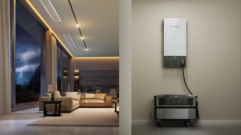
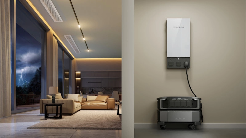
The EcoFlow DELTA Pro Ultra Whole-Home Backup Power supports 120V/240V output and provides 7.2kW of continuous AC output. In a compatible modular configuration, its storage can expand to as much as 90kWh.
Whether it can operate a particular heating system depends on startup demand, auxiliary heat strips, other loads, and the connection method. Fixed household circuits require approved transfer equipment and professional installation.
Prevent Pipes From Freezing
Open the cabinet doors beneath sinks on outside walls so room air can reach the supply lines. Move cleaning products first if children or pets are present.
A small stream from a vulnerable faucet may help during a severe freeze. Pay particular attention to plumbing in garages, crawl spaces, attics, and unfinished basements.
If the house will be empty, leave the heating system on. Setting the thermostat to at least 55°F is commonly recommended, although cold corners and poorly insulated spaces may fall below the thermostat reading.
A faucet producing only a trickle may have a frozen line. Leave it open and warm the accessible pipe gradually with a hair dryer, heating pad, or warm towels, beginning near the faucet. Never use a torch.
A frozen pipe may not leak until it thaws. If it has split, close the main water valve and stay out of water that may have reached electrical equipment. For step-by-step seasonal protection, review frozen pipe prevention before temperatures drop.
Follow Utility Restoration Updates
Report the outage through the utility’s official phone number, website, or app. Then turn on text alerts rather than repeatedly refreshing the outage map.
The first restoration time is an estimate. Crews may not know the extent of the damage until the wind settles or they inspect the circuit. Put the phone in low-power mode, and use a portable power station to keep compatible communication devices charged if the outage continues. Note warming-center locations before the house becomes dangerously cold.
Keep refrigerator and freezer doors closed. An unopened refrigerator generally stays cold for about four hours. A full freezer may hold for about 48 hours, or roughly 24 hours when half full. Use an appliance thermometer rather than tasting questionable food.
Leave sensitive electronics unplugged while power flickers. Once service appears stable, reconnect larger appliances one at a time.
Conclusion
The 2026–2027 outlook points toward a strong El Niño winter, with warmer seasonal odds across much of the North and wetter odds across much of the South and central U.S. That describes the average, not every week.
A polar vortex disruption may raise the chance of an Arctic outbreak, but no September forecast can identify its date or destination. Follow the updated forecast as winter develops instead of planning around distant cold-wave headlines.
In the meantime, handle the work that does not depend on the forecast: service the heating equipment, drain outdoor plumbing, prepare the car, set aside several days of supplies, and test the backup power intended for an outage. Those jobs will still be useful whether the winter delivers one major freeze, several smaller storms, or a season that is mostly mild.
FAQ
How Long Is a Polar Vortex Supposed to Last?
There is no fixed duration for a polar vortex disruption. The stratospheric disturbance can persist for days or weeks, while any resulting cold spell in a particular region may be much shorter. Some disruptions have little or no significant cold-weather impact on the United States.
What's the Difference Between an Arctic Blast and a Polar Vortex?
An arctic blast is a ground-level weather event, while the polar vortex is a high-altitude wind system. An arctic blast brings a rapid drop in temperatures and strong winds, while a weakened or disrupted polar vortex can contribute to widespread outbreaks of arctic air.
What Are the Signs of a Polar Vortex Collapse?
One key sign is sudden stratospheric warming (SSW), when Arctic stratospheric temperatures rise sharply within a few days. Weather models also monitor changes in high-altitude winds. A weakened or reversed circumpolar flow, along with a highly wavy jet stream, can indicate that the vortex is becoming disrupted.
What Areas Are Most Affected by the Vortex?
The northern Plains, Upper Midwest, Great Lakes, and New England are often affected by displaced arctic air. Areas such as Minnesota, Wisconsin, the Dakotas, and Michigan can experience severe cold, while major disruptions can also send freezing temperatures farther south into the Mississippi Valley, Texas, and the Gulf Coast.
For press requests or interview opportunities, reach out to our media team
media.na@ecoflow.com