Cyclones vs Anticyclones: What Are the Differences and How They Impact Our Power Systems
- What Defines a Cyclone and an Anticyclone
- How Do Cyclones and Anticyclones Differ in Their Weather Impacts
- The Distinct Challenges Each System Poses to Electrical Infrastructure
- How Energy Storage Responds to Different Weather Scenarios
- Regional Variations in Cyclone and Anticyclone Formation
- Monitoring and Forecasting These Atmospheric Giants
- Stay Prepared for All Weather Scenarios
- Frequently Asked Questions
Weather patterns shape our daily lives in countless ways. Two of the most influential atmospheric systems are cyclones and anticyclones. While both are large-scale air circulation systems, they create vastly different weather conditions and pose unique challenges to infrastructure, particularly electrical grids. Recognizing these differences helps us prepare for their distinct impacts.

What Defines a Cyclone and an Anticyclone
The fundamental distinction between these two systems lies in their air movement patterns and pressure characteristics.
Cyclone Basics
A cyclone is a low-pressure weather system where air spirals inward toward the center. In the Northern Hemisphere, this rotation occurs counterclockwise, while Southern Hemisphere cyclones rotate clockwise. The Coriolis effect, caused by Earth's rotation, determines these directional patterns. Near the equator, the Coriolis force becomes too weak to generate significant rotation, which is why cyclones rarely form within about 5 degrees of the equator.
As air converges at the surface, it has nowhere to go but up. This upward motion cools the air, causing water vapor to condense. Clouds form, often leading to precipitation. The intensity varies widely, from mild rain showers to violent thunderstorms or even tropical hurricanes.
Anticyclone Characteristics
An anticyclone represents the opposite scenario. High atmospheric pressure at the center pushes air outward and downward. This circulation rotates clockwise in the Northern Hemisphere and counterclockwise in the Southern Hemisphere.
The descending air warms as it compresses, which discourages deep cloud formation. Depending on moisture and season, this can mean clear skies, or persistent low cloud, fog, and haze under a temperature inversion. These systems often bring extended periods of stable weather, though the specific conditions depend on the season and location.
How Do Cyclones and Anticyclones Differ in Their Weather Impacts
The contrasting pressure systems create markedly different atmospheric conditions.
Precipitation Patterns
Cyclones rank among the most important generators of wet weather in many regions, though other mechanisms like orographic lifting and frontal boundaries also produce significant rainfall. The rising air within these systems creates ideal conditions for cloud development and rainfall. Some cyclones produce gentle, widespread rain that lasts for days. Others generate intense, localized downpours accompanied by severe thunderstorms.
Anticyclones suppress precipitation. The sinking air inhibits cloud formation, resulting in dry conditions. During summer, this often means sunny, pleasant days. Winter anticyclones can bring crisp, cold weather with bright blue skies.
Wind Behavior
Wind speeds differ substantially between these systems. Cyclones typically generate stronger, more variable winds. The steeper the pressure gradient around a cyclone, the more intense the winds become. Coastal areas may experience gale-force winds during powerful cyclonic events.
Anticyclones usually produce lighter, calmer winds. The gentle pressure gradients create mild breezes rather than strong gusts. This stability makes anticyclonic periods ideal for outdoor activities, though stagnant air can trap pollutants near the surface.
Temperature Variations
Temperature responses vary by system type and season. Summer cyclones often bring cooler temperatures through cloud cover and precipitation. Winter cyclones may draw in warmer air from different regions, potentially causing temperature fluctuations.
Anticyclones amplify seasonal extremes. Summer anticyclones trap heat, creating prolonged hot spells or even heat waves. Winter anticyclones allow heat to escape from the surface at night, leading to very cold conditions and potential frost.
The Distinct Challenges Each System Poses to Electrical Infrastructure
Modern power grids face different vulnerabilities depending on which atmospheric system dominates.
Cyclonic Threats to Power Systems
What's a cyclone's most dangerous characteristic for electrical infrastructure? The immediate, physical damage it can inflict.
Strong winds associated with cyclones can snap power lines, topple transmission towers, and damage transformers. Heavy rain increases the risk of equipment short-circuits and flooding of substations. Lightning strikes during cyclonic thunderstorms may cause surges that overwhelm protective systems.
These events often trigger sudden outages that can range from localized to widespread depending on the cyclone's size and intensity. Restoration can take days or even weeks if infrastructure suffers extensive damage. Repair crews must wait for conditions to improve before accessing affected areas safely.
Anticyclonic Pressures on Energy Demand
Anticyclones create a different kind of stress. Extended periods of extreme temperatures drive electricity consumption to peaks that strain grid capacity.
Summer anticyclones cause air conditioning usage to surge across entire regions simultaneously. The prolonged nature of these high-pressure systems means elevated demand doesn't just spike for a few hours but persists for days or weeks. Power plants must run continuously at maximum capacity, increasing the likelihood of equipment failures from overheating or mechanical stress.
Winter anticyclones present similar challenges in cold climates. Heating demands soar as temperatures plummet. The grid operates under sustained high loads without the natural relief that comes from temperature moderation.
| System Type | Primary Grid Threat | Duration | Impact Nature |
| Cyclone | Physical damage to infrastructure | Hours to days | Sudden outages ranging from local to widespread; restoration depends on access and damage extent |
| Anticyclone | Demand overload | Days to weeks | Sustained strain, potential brownouts |
How Energy Storage Responds to Different Weather Scenarios
The contrasting nature of cyclonic and anticyclonic challenges has highlighted the value of energy storage systems in maintaining grid reliability.
Emergency Power During Cyclonic Events
When cyclones knock out grid power, stored energy becomes a critical resource. Battery systems can immediately supply electricity to essential loads like medical equipment, refrigeration, and communication devices. This capability proves especially valuable in areas where restoration may take considerable time.
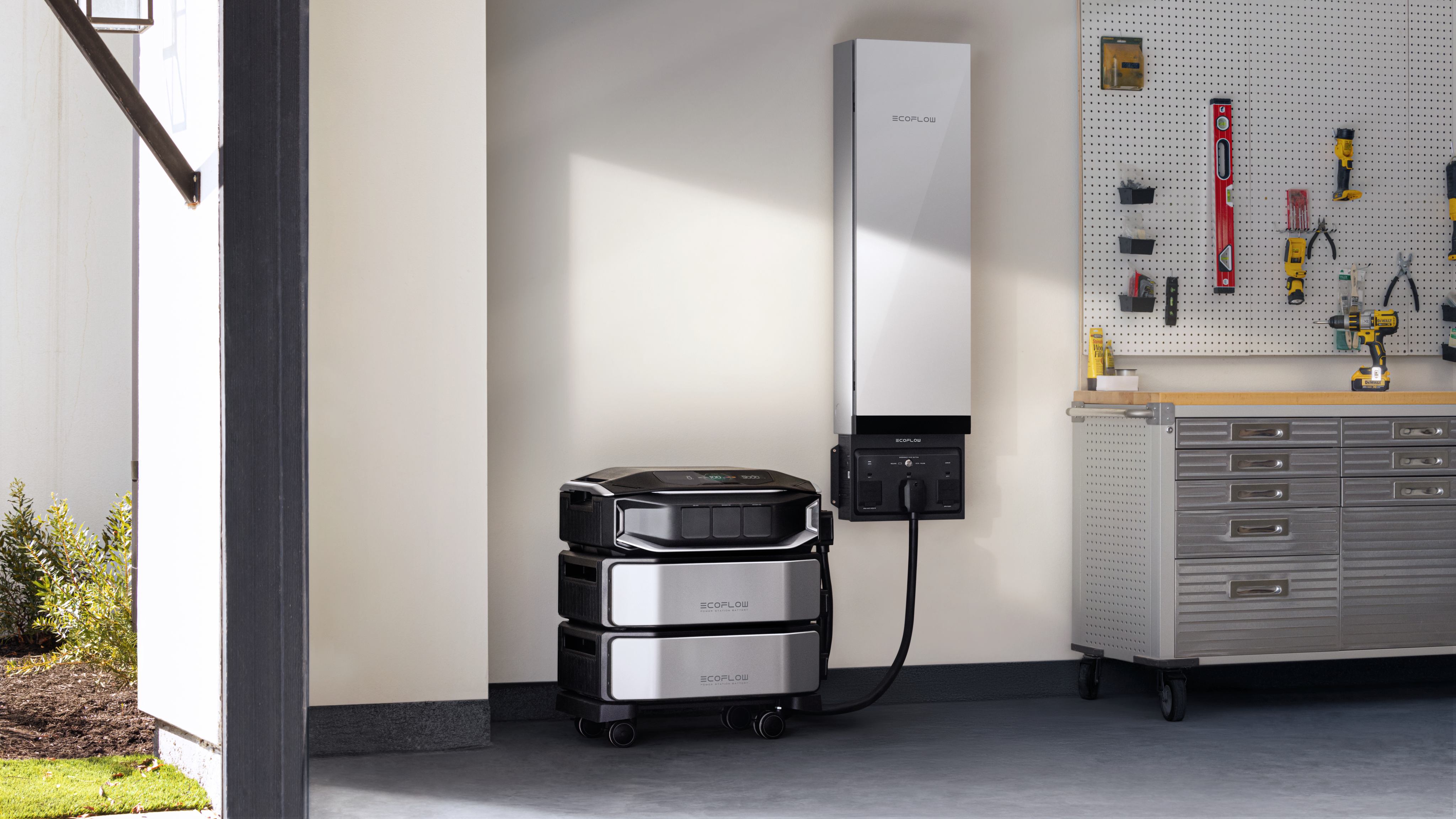
The automatic switching that modern storage systems provide means no manual intervention is needed. Power transitions seamlessly from grid to battery backup, maintaining continuous operation of critical systems. Advanced home energy systems like the DELTA PRO ULTRA X offer expandable capacity that can power entire homes through extended outages, with the ability to scale up to meet varying household needs during cyclonic emergencies.
Peak Shaving During Anticyclonic Strain
Anticyclones create opportunities for a different storage application. During the sustained high-demand periods these systems cause, stored energy can discharge during peak hours to reduce grid stress.
This peak-shaving function works by charging batteries during off-peak times when demand is lower and electricity may be cheaper or cleaner. When anticyclonic heat or cold drives consumption upward, the stored energy supplements grid supply. This approach helps flatten demand curves and prevents overloading.
The buffering effect reduces the risk of rolling blackouts during extended extreme weather. Grid operators gain flexibility to manage supply and demand more effectively.
Long-Term Resilience Building
Both scenarios demonstrate how energy storage enhances overall grid resilience. The technology addresses immediate emergency needs while also providing strategic benefits for managing predictable but intense demand periods.
Communities with distributed storage capacity can better withstand the diverse challenges that both cyclones and anticyclones present. This dual capability makes storage increasingly relevant as weather patterns become more variable.
Regional Variations in Cyclone and Anticyclone Formation
Geography plays a significant role in determining where and when these systems develop.
Tropical vs Mid-Latitude Systems
Tropical cyclones form over warm oceans, typically requiring sea surface temperatures above about 26.5°C, especially when the warm water extends to sufficient depth. These powerful systems draw energy from ocean heat and moisture. They're seasonal phenomena, occurring most frequently during late summer and early autumn in their respective hemispheres.
Mid-latitude cyclones develop along temperature boundaries between air masses. These systems can occur year-round and drive much of the day-to-day weather variability in temperate regions. They're typically less intense than their tropical counterparts but more frequent.
Anticyclones form in various settings. Subtropical anticyclones are semi-permanent features over ocean basins. Continental anticyclones develop over large land masses, particularly during winter months when surfaces cool dramatically.
Seasonal Movement Patterns
The position and strength of these systems shift with the seasons. Summer sees subtropical anticyclones strengthen and expand, often bringing persistent dry weather to affected regions. Winter allows polar anticyclones to develop and occasionally push equatorward, delivering cold air outbreaks.
Cyclone tracks also vary seasonally. Tropical systems follow specific paths influenced by steering currents in the atmosphere. Mid-latitude cyclones tend to track along jet stream positions, which migrate north and south with the seasons.
Monitoring and Forecasting These Atmospheric Giants
Modern meteorology has developed sophisticated tools for tracking and predicting both system types.
Satellite imagery provides continuous visual monitoring of cloud patterns and system development. Weather radars detect precipitation intensity within cyclones. Surface observations from thousands of stations feed real-time data into forecasting models.
Numerical weather prediction models simulate atmospheric behavior by solving complex equations. These models have become increasingly accurate at forecasting cyclone paths and intensity several days in advance. Anticyclone predictions often extend even further because these systems evolve more slowly.
The improved forecasting allows utility companies to prepare for potential impacts. Crews can be pre-positioned before cyclonic events. Load forecasts can be adjusted when anticyclones threaten to create demand surges.
Stay Prepared for All Weather Scenarios
Cyclones and anticyclones will continue to influence our weather and test our infrastructure. The difference between cyclones and anticyclones means we need to prepare differently to face each threat. Unlike cyclones, which demand preparedness strategies to deal with sudden outages and physical impacts, anticyclones demand preparedness strategies to deal with sustained demand pressures. The key to preparing well is to learn about the difference between each system.
Frequently Asked Questions
Q1: How Do Cyclones and Anticyclones Differ in Their Rotation Direction?
Cyclones rotate counterclockwise, whereas anticyclones rotate clockwise in the Northern Hemisphere. However, the rotation direction of the two phenomena reverses in the Southern Hemisphere because of the Coriolis Effect. The rotation direction is set by the Coriolis effect acting on air moving in response to pressure differences; near the surface, friction causes air to spiral inward toward lows and outward from highs.
Q2: What Is an Anticyclone's Impact on Air Quality?
Anticyclones have an adverse impact on air quality, as they tend to trap pollutants near the ground. The falling air behaves like a lid, preventing the upward motion of air, which would otherwise cause the pollutants to rise. The light winds in an anticyclone situation do not enhance the horizontal dispersion of pollutants. Smog forms in urban areas during an anticyclonic situation, especially in summer.
Q3: Can Cyclones and Anticyclones Exist Simultaneously in the Same Region?
Yes, these systems often occur together in neighboring areas as part of a single weather pattern. Cyclones and anticyclones often occur together, where a wave pattern is formed by a low-pressure trough associated with a cyclone, coupled with a high-pressure ridge associated with an anticyclone. The combination creates a wave pattern that forces winds to travel from a high-pressure zone to a low-pressure zone.
Q4: What's a Cyclone's Typical Lifespan Compared to an Anticyclone?
A cyclone’s lifespan is shorter, lasting several days to a week, while an anticyclone’s is longer, lasting weeks. A mid-latitude cyclone lasts for 2 to 5 days as it crosses a given area, while a tropical cyclone lasts a week or two, but only affects a given area for a shorter time. An anticyclone, especially a subtropical high-pressure system, may remain stationary for a long time, preventing weather systems from passing through.
Q5: Which System Poses Greater Risk to Human Safety, Cyclones or Anticyclones?
A cyclone poses a greater danger because it is associated with more immediate severe weather events. However, an anticyclone poses a danger to human health, although it is a slower-developing threat, as it is associated with heat waves, cold snaps, and reduced air quality.
For press requests or interview opportunities, reach out to our media team
media.na@ecoflow.com