Supercell Storm Ontario: Warning Signs, Safety Tips and Storm Preparation Guide
Many summer thunderstorms pass quickly and move on. Supercells don’t. These storms bring straight-line winds that top 120 km/h, hail big enough to crater car hoods, rain that floods basements in under an hour, and tornadoes, sometimes violent ones. Knowing what to look for in the sky and getting your home ready before warnings drop improves your ability to respond. This guide covers how supercells form, the warning signs worth learning, and the practical steps that protect your household when severe weather arrives.
What Is a Supercell Storm and Why Is It Dangerous in Ontario?
A typical summer storm collapses on itself in under an hour, cold rain falls through the warm updraft that feeds it, and the engine dies. Supercells sidestep that fate entirely. They can sustain themselves for hours, tracking across hundreds of kilometres while dumping destructive weather on every town in the path.
Supercell Storm Formation Process
Supercells often develop when warm, moist air interacts with cooler, drier air and strong wind shear in the atmosphere. Wind shear at higher altitudes, wind that changes speed and direction sharply as you go up, tilts the rising column and sets it spinning. That rotating core is called a mesocyclone. It acts like an engine, pulling in warm surface air and converting it into hours of sustained power.
Supercells vs. Regular Thunderstorms
The physics are straightforward. In a regular storm, cold rain drops straight through the warm updraft that created it. The fuel supply gets cut off, and the whole thing fizzles in under an hour. In a supercell, strong wind shear tilts the updraft, while upper-level winds push the cold downdrafts away from the warm inflow. The separation allows the storm to maintain its structure for longer. Without that separation, the storm dies fast. With it, a supercell can travel for hours and tear through multiple counties before weakening. That’s why supercells often lead to some of the worst severe weather alerts in Southern and Eastern Ontario every summer, always make sure you check weather alerts for Ontario’s severe thunderstorms, as they can travel hundreds of kilometres across Southern and Eastern Ontario while producing damaging weather.
Common Hazards From Supercell Storms
The worst ones spin off EF-2 or stronger tornadoes. Straight-line downbursts exceed 120 km/h. Large trees can break or uproot. Shingles tear off. Utility poles go down, sometimes across whole townships. The rainfall rate floods low-lying streets and underpasses within minutes. Hail reaches golf ball size or bigger, enough to dent vehicles, crack shingles, and shred patio furniture left uncovered. When severe winds bring down utility lines and cause outages, a portable power station can help keep essential devices powered during the recovery period.


How Can You Identify Supercell Storm Warning Signs?
Supercells can develop quickly, and conditions can change fast. Learn the visual cues and you buy yourself precious minutes to act, time that makes the difference between being caught off guard and already being in the basement when the sirens kick in.
Notice Sudden Weather Changes
Watch for conditions that shift fast and shift hard. Temperature drops sharply, enough that you feel it on your skin within seconds. Wind shifts direction suddenly and gusts hard from strange angles, not the steady breeze it was five minutes earlier. Overhead, the clouds may take on a greenish-dark cast. This can happen during some severe thunderstorms when large hail and dense clouds affect how sunlight passes through the storm.
Recognize Rotating Clouds, Hail and Strong Winds
A wall cloud hanging low and spinning beneath the main storm base is the clearest visual cue that funnel clouds or a tornado could follow. It can look unusual because one section of the cloud base appears to rotate while the surrounding sky remains relatively still. Another unmistakable sign: heavy rain cuts off abruptly. No tapering, no drizzle. Just silence, then isolated hail, golf ball size, sometimes baseball size, pounding down out of nowhere. Then the sound hits. A low, steady roar that doesn’t let up is sometimes compared to a freight train or a jet engine at full throttle. That roar can be a sign of extremely strong winds or a nearby tornado. Seek shelter immediately.
Check Ontario Weather Alerts
Official alerts fill in what the naked eye might miss, especially at night or when the storm is still far off. Environment and Climate Change Canada (ECCC) issues weather watches and warnings based on radar and spotter reports. These should be the first thing you check when severe weather is in the forecast. Keep emergency notifications enabled on your phone. Don’t silence them during storm season. Once a severe thunderstorm or tornado warning is issued, alerts on your phone can help you respond quickly. Local radio and TV stations run updates worth keeping on in the background too, especially if power and cell towers are still operational. The more information you have, the less guesswork you’re doing when the storm closes in.
What Should You Do During a Supercell Storm in Ontario?
A severe thunderstorm or tornado warning hits your phone, that’s the moment to move, not debate. Fast action helps reduce exposure to flying debris and severe weather hazards. Acting quickly reduces exposure to flying debris.
Take Shelter During Severe Storms
A basement is usually the preferred shelter if available. No basement? Move to a windowless room on the main floor, interior bathroom, hallway, or closet. Think small and windowless. A tight bathroom or closet buried in the middle of the house gives you more protection than any big room with glass facing the storm.
Respond to Tornado Warnings Safely
Flat on the floor, face down. Arms over your head and neck. Grab whatever padding is close, mattress, blankets, a heavy winter coat, and pull it over your head and neck. Lying flat protects the areas debris is most likely to hit. The more layers between you and the flying objects, the better. Caught driving when the warning drops? Overpasses are not shelters. Wind funnels through them and actually speeds up. Pull off the road where it’s safe, keep the seatbelt fastened, and crouch low, below the window line, head covered. If there’s no building nearby and the car is your only option, stay in it. Buckled, ducked down, hands or a jacket protecting your head and neck.
Protect Yourself From Hail and Debris
Exterior windows, skylights, sliding doors, put distance between yourself and all of them. Glass shatters fast under hail and wind-driven debris. Once a window goes, the shards travel across the room. An interior space with no windows at all is one of the safest places to wait it out. Close the curtains or blinds, they won’t stop the impact, but they catch some of the fragments. Shut bedroom and hallway doors to contain glass splinters to one area if a window blows in.
Avoid Flooded Roads and Areas
Supercell rain floods streets and underpasses in minutes, often before you realize the water is rising. Flooded pavement isn’t worth the gamble. Six inches of fast water knocks a person down. About 30 centimetres of moving water can affect vehicle control. Go deeper and the vehicle starts to float. At that point, you may no longer be in control. Underpasses fill fastest and deepest. Find another route or wait it out.
How Can Ontario Homeowners Prepare for Supercell Storms?
A few hours of preparation before storm season hits can improve your ability to respond quickly. Emergency supplies, a secured yard, basic home maintenance, and backup power, cover those four and you’re not scrambling when a warning drops.
Build an Emergency Kit for Storms
Start with a 72-hour kit. The Government of Canada recommends one for every household, food, water, and supplies for three full days. Pack it in something waterproof. Keep it where you can grab it in under a minute.
Stored or bottled water (two litres per person per day for drinking, cooking and hygiene)
Non-perishable food and a manual can opener
First-aid supplies and prescription medications
Flashlights and spare batteries
Important personal documents sealed in a waterproof container
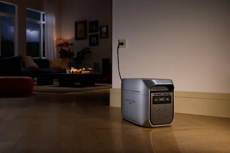
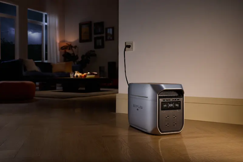
Communication matters as much as clean water during a blackout. When cell towers are overloaded or damaged, keeping a phone alive, a Wi-Fi router running, and an emergency radio powered keeps you connected to updates and able to reach family. For the short-term outages that follow windstorms, a battery unit stored in the supply closet simplifies everything. The EcoFlow DELTA 3 Classic Portable Power Station produces no combustion fumes and can provide power for phones, LED lamps, and other essential electronics.
Secure Outdoor Items Around Homes
Downburst winds turn loose yard items into missiles. Patio chairs, the barbecue, sports equipment, potted plants, garbage bins, if it’s not anchored, it needs to go inside. Garage or shed, before the storm arrives. Loose items turn into projectiles fast. Chairs, bins, flower pots, at 120 km/h, any of it shatters glass or tears through siding. A quick pass through the yard before the storm arrives prevents that damage.
Inspect Roofs Gutters and Trees
Overhanging dead limbs near the roof or lines? Cut them back now. Better to cut them down on a calm afternoon than watch the wind tear them off. Gutters need clearing in spring and fall, a supercell dumps rain fast, and clogged drains push water under the shingles. Once a year, check the roof for loose or cracked spots. Seal anything that looks like a leak waiting to happen.
Prepare Backup Power for Extended Outages
Supercell winds bring down mature trees, snap utility poles, and damage electrical lines across affected areas. These outages are not always brief interruptions that resolve within minutes. In some rural communities, storm-related power outages can last several days depending on the extent of damage and repair conditions. Small power banks may keep phones running, but they are not designed to support larger household needs during extended outages.
A battery backup with enough capacity can help reduce the impact of an outage by keeping essential devices running. The EcoFlow DELTA 3 Max Plus Portable Power Station provides backup power for compatible appliances, including refrigerators, chest freezers, and some sump pumps. Unlike fuel-powered generators, it produces no combustion fumes during operation and does not require outdoor exhaust.
How Can You Recover After a Supercell Storm in Ontario?
Don’t step outside until officials confirm it’s safe. The first walkthrough has a simple order: look for damage, take pictures of everything, then deal with the urgent stuff that’ll get worse if left alone.
Check Homes for Storm Damage
Walk around the property slowly. Missing shingles, cracked siding, shattered windows, fresh cracks along the foundation, those are the obvious signs. Check above you first. Power lines sagging or down, poles leaning at odd angles, water pooled around electrical boxes, those are the dangers that injure people after the storm has already passed. Assume any downed line is live. Stay back and call the utility company.
Document Damage for Insurance Claims
Grab your phone and shoot everything before cleanup starts. Close-ups matter, foundation cracks, shattered windows, shingles torn off. Wide shots of each damaged area give adjusters the full picture. The more visual proof you have, the less back-and-forth with the insurance adjuster later.
Restore Power Safely After Storms
Before touching the breaker panel, check for moisture around outlets and switches. Water in the basement or anywhere near the main electrical panel means calling a licensed electrician, don’t flip breakers or plug anything in until it’s been inspected. While waiting for grid repairs, or for an electrician to inspect your panel, a solar generator can provide temporary power for essential devices while repairs are underway. Match the unit to what you actually need to power in the interim.
Repair Damaged Home Areas Safely
Temporary fixes stop things from getting worse. Tarps over damaged roof sections, plywood over broken windows, those buy you time until permanent repairs. For structural damage, large fallen trees, or anything involving the electrical system, hire licensed and insured contractors. The risk of doing it yourself isn’t worth the hospital visit or the denied insurance claim.
Conclusion
Supercells rank among Ontario’s most dangerous weather events, winds that level trees, hail that smashes vehicles, and tornadoes that form with little warning. Getting through storm season intact comes down to what you do before the sky turns. Learn the visual cues. Monitor ECCC alerts. Have a shelter spot picked out before you ever need it. Stock a 72-hour kit and keep a power station like the EcoFlow DELTA Series charged and ready, those preparations reduce last-minute stress. An afternoon of preparation now is what keeps essential devices powered and supports household preparedness.
FAQ
What Makes a Supercell Dangerous?
The rotating core, called a mesocyclone, is what separates a supercell from an ordinary storm. That rotating updraft fuels the worst of it, tornadoes, hail the size of golf balls, downburst winds, and torrential rain that triggers flash flooding. Ordinary storms burn out fast. A supercell doesn’t. Its structure separates the inflow from the rain, so the engine keeps running while the storm pushes across the landscape. Towns in its path can get hit one after another over several hours.
Do Supercell Storms Always Produce Tornadoes?
Not always. A supercell can spin for hours without dropping a tornado. The rotation that defines a supercell means a tornado can spin up at any stage. Even when one never materializes, the storm still packs destructive hail, straight-line winds, and flooding. Ontario sees significant damage from supercells every summer, funnel cloud or not.
Where Is Tornado Alley in Ontario?
Ontario’s Tornado Alley covers the southwestern and southern reaches of the province, Windsor-Sarnia through London, Kitchener-Waterloo, and into the Golden Horseshoe and Simcoe County. Late spring into summer, the atmosphere across this corridor becomes unstable enough to generate severe weather regularly.
How Long Does a Supercell Storm Last?
Two to four hours is typical for most supercells, far longer than a standard afternoon thunderstorm. With the right setup, a long-track supercell lasts six hours or longer. That’s enough time to cross several counties, leaving a damage trail that stretches across a big chunk of the province.
Can Supercells Be Predicted?
The conditions that produce supercells can be spotted days in advance. Meteorologists issue regional watches based on those patterns well before the first storm fires. Pinpointing the exact location of a tornado touchdown is a different challenge, that usually happens minutes ahead of time, using Doppler radar to detect rotation inside the storm.