Gale Warning: What Strong Marine Winds Mean Before a Lake or Coastal Trip
- What a Gale Warning Means for Marine Travel Plans
- Why Gale-Force Wind Can Produce Very Different Water Conditions
- How a Gale Warning Affects Common Lake and Coastal Trips
- How to Read the Full Marine Forecast Before Departure
- What to Do Before Gale-Force Winds Reach the Area
- How Backup Power Supports a Delayed Departure
- Check Before You Go
- Frequently Asked Questions
A gale warning can change a pleasant lake crossing or coastal weekend into a travel decision. It identifies a defined marine wind range, not a vague forecast for breezy weather. Before boarding a ferry, launching a kayak, fishing, or parking beside exposed water, check the warning area, timing, and wind direction. For paddling and recreational small-craft trips, gale-force winds are a clear reason to postpone and stay ashore.
What a Gale Warning Means for Marine Travel Plans
In Canada, a gale warning has a specific wind threshold. A warning is issued when winds of 34 to 47 knots, excluding gusts, are occurring or forecast over a marine area. That equals 63 to 87 km/h, or 39 to 54 mph. The threshold describes sustained marine wind, which can build waves, create spray, and make control difficult.
Canada’s marine warning categories place that range between two other wind levels. This comparison shows where gale-force winds fall within Canada’s marine warning categories.
Marine Warning | Wind Range | Approximate Speed |
|---|---|---|
Strong Wind Warning | 20–33 knots | 23–38 mph |
Gale Warning | 34–47 knots | 39–54 mph |
Storm Warning | 48–63 knots | 55–72 mph |
These thresholds come from the Canadian marine warning program. On the Great Lakes, Strong Wind Warnings are seasonal, while Gale and Storm Warnings mark higher wind bands. Elsewhere, use the local marine service because alert names may differ.

Sustained Wind
Next, notice that the threshold excludes gusts. A forecast of 25 knots gusting to 38 knots is not the same as sustained 38-knot wind under this Canadian system. Gusts still matter to a small boat, paddle craft, tent, or awning, but the label follows the issuing service’s sustained value.
Warning Area
Just as important, a warning covers a marine zone, not every beach, road, or harbour equally. Hills, islands, bays, channels, and shoreline orientation can alter local wind. Read the named zone and any “except” statement, then match your launch, route, marina, or campsite.
Why Gale-Force Wind Can Produce Very Different Water Conditions
Even within one wind band, conditions vary sharply. A gale warning gives an essential wind signal, but it does not promise one wave height everywhere. Wave growth depends on wind duration, open water upwind, direction, depth, currents, and shoreline shape.
Fetch and Duration
For example, fetch is the uninterrupted distance wind travels across water. A 35-knot wind along a large lake’s long axis has more room to build waves than the same wind crossing a protected bay. Several steady hours can create a rougher surface than a brief onset.
Direction and Shore
Meanwhile, direction changes the experience. Offshore wind may make a beach look flatter while pushing a kayak away from shore. Onshore wind can drive waves toward launches, campgrounds, and waterfront roads. Crosswinds complicate docking, trailering, and narrow-channel handling.
A calm-looking harbour may sit behind a breakwater while conditions beyond it are much rougher. The Beaufort wind scale associates gale-force winds with high waves, foam streaks, spindrift, and reduced visibility from spray. These open-water indicators do not replace the current forecast.
How a Gale Warning Affects Common Lake and Coastal Trips
From there, apply the warning to the activity, vessel, and exposure. One forecast can stop paddling, delay a ferry, and leave a sheltered land itinerary possible. Skill does not remove vessel limits, operator rules, cold-water risk, or distance from shelter.
Ferries and Crossings
For lake crossings and ferries, check the operator directly before leaving. A gale warning does not automatically cancel every sailing. Vessel size, route orientation, harbour conditions, waves, and company limits influence the decision. Delays may also continue after winds ease because boats and crews must return to position.
Keep a land route, lodging option, and extra time in reserve. An outbound departure does not guarantee the return sailing. For a fixed reservation, identify the cancellation time and operator’s message channel.
Fishing and Powerboats
For anglers and small powerboats, 34 to 47 knots is a major operating concern. Waves can reduce visibility, throw occupants off balance, move loose equipment, and make a familiar inlet difficult. Turning around may become harder if following seas, crosswinds, or breaking waves affect the route home.
A larger engine does not solve wave exposure. Boat design, loading, freeboard, bilge condition, fuel, experience, and shelter access all matter. If the warning overlaps the trip, postponement is generally sensible for recreational small craft.
Kayaks and Paddleboards
For paddlers, the margin can disappear much earlier than gale force. Wind can prevent progress, separate a group, and chill a wet person quickly. Inflatable craft and paddleboards present large surfaces to crosswinds. A close shoreline does not guarantee an easy landing when rocks, surf, or steep banks block access.
Treat the warning as a reason to choose a land activity. Do not test conditions from the water. Even a short paddle can become an uncontrolled drift in offshore wind.
Marinas and Launches
At a marina, the safest preparation usually happens before the wind arrives. Confirm mooring lines, fenders, covers, shore-power arrangements, and local instructions while docks remain safe. Remove items that can blow away. Avoid walking onto exposed docks once waves, spray, or violent movement make footing uncertain.
At launch ramps, crosswinds can swing a boat or trailer while waves wash over the ramp. Congestion may rise as boaters retrieve vessels. Early action must not override a closure or require an unsafe dock.
Campsites and RV Stops
Along the shoreline, camping and RV risks extend beyond boating. Branches, loose awnings, tents, canopies, and outdoor furniture can become hazards. Wave run-up may reach paths or low sites. Wind can also affect high-profile vehicles on bridges and open roads, even when the marine alert itself does not serve as a road warning.
Move from exposed trees, eroding edges, and wave-washed areas when officials or site staff advise it. Retract awnings, store loose gear, and locate sturdy indoor shelter. Follow road alerts separately because marine categories do not describe every driving hazard.
How to Read the Full Marine Forecast Before Departure
Now, move beyond the warning headline. The regular marine forecast adds the details needed for a sound decision. Read the issue time first, then confirm the zone, warning status, wind direction and speed, wave forecast, visibility, precipitation, and expected change.
Pay close attention to timing words such as “increasing,” “diminishing,” “veering,” and “shifting.” A trip scheduled before the stated onset still needs a return margin. Rough water may remain after winds begin to fall.
Use this short departure check:
Match the alert’s marine zone to the full route.
Compare onset and end times with travel, setup, and return time.
Check wind direction against exposed crossings and shorelines.
Read wave, visibility, thunderstorm, and freezing-spray information.
Review buoy observations and the latest update near departure.
Confirm ferry, marina, campground, bridge, and road notices separately.
Canada posts marine forecasts, wave information, and buoy observations through its marine weather services. A phone weather app may summarize conditions, but a marine bulletin usually offers better zone detail. Save the forecast source before entering an area with weak reception.
What to Do Before Gale-Force Winds Reach the Area
Once a warning appears, priorities should shift from preserving the schedule to reducing exposure. Decide early whether to delay, reroute, or replace the water activity. Tell the group, including anyone meeting at the destination, so nobody leaves on outdated assumptions.
Finish safe, land-based tasks before the arrival window. Fuel the vehicle, secure outdoor items, move the boat if authorized, and charge essential electronics. Download maps, contacts, and forecast screenshots. Wait away from exposed docks, trees, surf, and waterfront edges.
Never enter rough water to check whether the warning “feels accurate.” Shore views may hide stronger wind farther out. If officials, marina staff, ferry crews, park managers, or emergency personnel close an area, follow the closure.
How Backup Power Supports a Delayed Departure
During a weather delay, practical needs continue. Phones carry alert updates, navigation, reservations, and family messages. A mobile hotspot may help when local internet fails. Lights make a cabin or parked RV easier to manage, while refrigeration protects food and certain temperature-sensitive supplies.
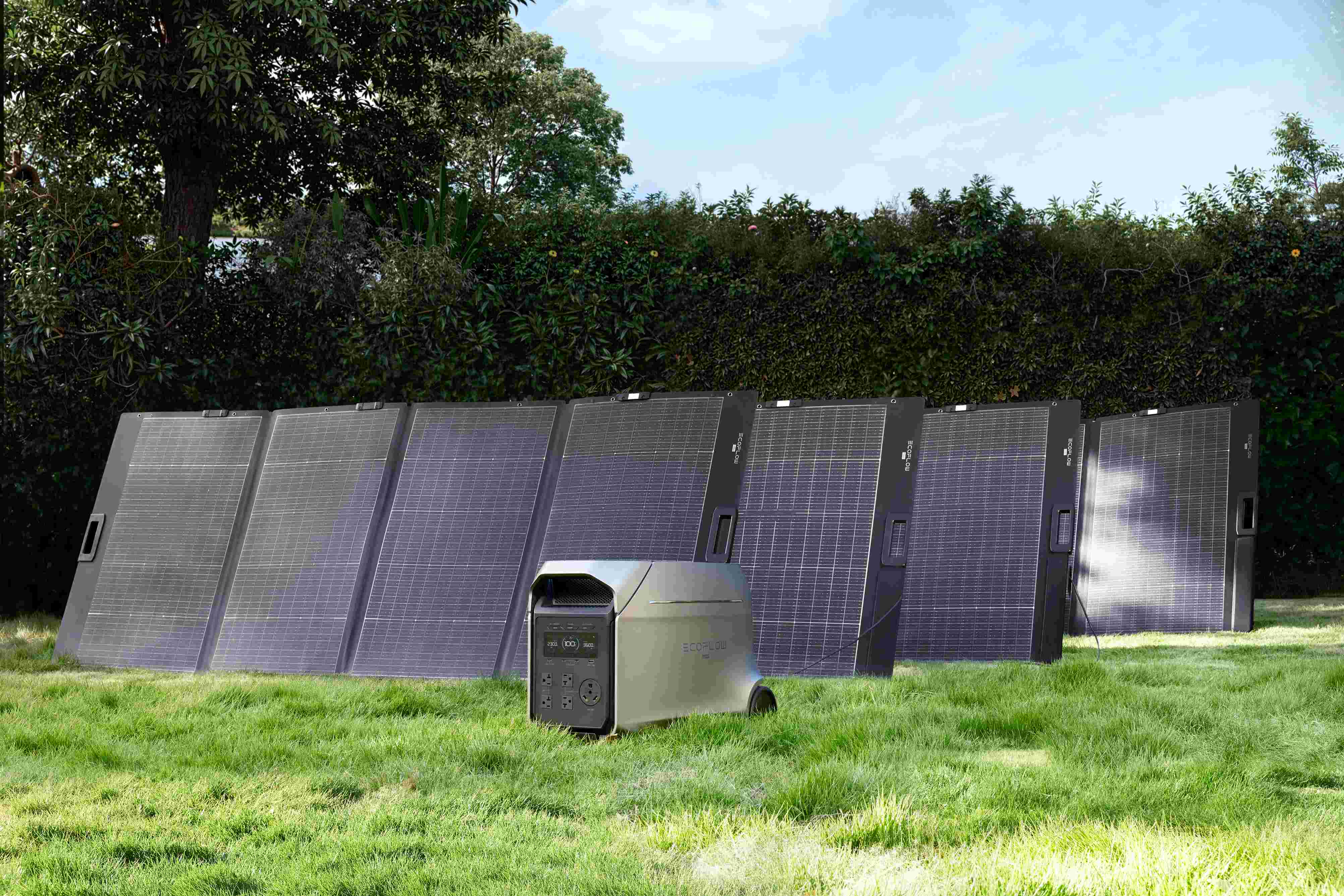
This is where a planned power setup can support the wait. The EcoFlow D3UP+400W package pairs a 3,072Wh portable power station with 3,600W rated AC output and a 400W solar panel, according to the official product information. It may run selected devices when total demand, startup watts, connection requirements, and available energy remain within its limits.
Charge the unit before conditions deteriorate and set priorities. Phones, a navigation device, LED lights, a hotspot, and refrigeration usually deserve attention before convenience loads. Estimate runtime from actual wattage, allow for conversion losses, and keep reserves for communication.
Portable power station does not make an exposed campsite, unsafe road, or cancelled crossing suitable. Keep equipment dry and ventilated, follow its manual, and place solar panels only when wind conditions allow safe setup. During a gale warning, a loose panel can become a dangerous object. Wait for a safer weather window before deploying it.
Check Before You Go
A gale warning signals sustained marine winds of 34 to 47 knots under Canada’s system. That range can create dangerous waves, spray, difficult docking, and exposed shoreline hazards. Read the full marine bulletin, verify local closures, and compare timing with the entire return journey. Delay small-craft plans when conditions exceed safe limits. Check the latest forecast before every departure today.
Frequently Asked Questions
Q1: Is a Gale Warning the Same as a Storm Warning on the Great Lakes?
No, under Canada’s categories. A gale warning covers 34 to 47 knots, while a Storm Warning covers 48 to 63 knots, excluding gusts. Both require close attention to the full marine bulletin.
Q2: Does a Gale Warning Automatically Cancel Every Ferry Sailing?
No, operator decisions vary. Ferry size, route, waves, harbour access, and company limits affect cancellations. Check the operator’s latest notice and prepare for delays in either direction.
Q3: Can the Shore Look Calm While a Gale Warning Is Active Offshore?
Yes, in sheltered locations. Breakwaters, islands, hills, and offshore wind can hide rougher conditions beyond the visible shoreline. Use zone forecasts and buoy reports rather than a parking-lot observation alone.
Q4: Should an RV Leave a Shoreline Campsite During a Gale Warning?
Sometimes, when local exposure is unsafe. Follow campsite and emergency instructions, then consider trees, wave run-up, erosion, bridge winds, and road alerts. Move early only when the route and destination are safer.
Q5: Does a Gale Warning Cover Squalls or Freezing Spray?
No. A Gale Warning refers specifically to sustained winds of 34 to 47 knots. Squalls, freezing spray, waterspouts, high water levels, and other hazards may appear under separate warnings, watches, advisories, or forecast sections. Always read the full marine bulletin.