Why Arctic Air Outbreaks Travel So Far South: The Science Behind the Freeze
- What Is Arctic Air?
- How the Polar Jet Stream Affects Arctic Air Movement
- The Path of Arctic Air: From the North to the South
- When Is the Arctic Blast Coming in 2025?
- How to Get Ready for Arctic Outbreaks in Southern Cities
- Long-Term Implications of Frequent Arctic Air Outbreaks
- Prepare for the Next Arctic Blast
- FAQs on Polar Vortex & Arctic Air
Winter typically brings the expected cold. But if the forecast map goes a deep purple color, it means that a huge blast of arctic air is breaking out of the North Pole. As this cold air moves south, it hits places that don't usually get snow. This is a very bad weather event that could crash the power grid and leave millions of people without heat. Here is what you need to know to get ready.
What Is Arctic Air?
To understand the freeze, we must first define the source. Arctic air is a mass of extremely cold, dry air that forms over the Arctic region. Because the poles receive little to no sunlight during the winter, the ground (or ice) radiates heat out into space, cooling the surface intensely. The air sitting above this ice chills rapidly, becoming dense and heavy.
Normally, this cold air is content to sit at the North Pole. It builds up a high-pressure dome, creating a reservoir of freezing temperatures. Under standard conditions, atmospheric circulation keeps this frigid air contained within the Arctic Circle. However, the atmosphere is a fluid, constantly in motion, and when the barriers holding this air back weaken, we experience what is known as an arctic blast.
How the Polar Jet Stream Affects Arctic Air Movement
The polar jet stream is the main thing that keeps the cold north from getting to the warm south. This fast-moving river of high-altitude air moves from west to east and separates the cold air from the poles from the warmer air in the middle latitudes.
What the Polar Jet Stream Does
The jet stream is like a wall. Zonal flow is a strong, straight "fence" that keeps the cold air in the Arctic where it belongs. The arctic polar vortex spins counterclockwise. It is a big area of low pressure and cold air that surrounds both of the Earth's poles. This helps the jet stream stay strong and the cold air stuck in place.
How Wind Patterns Bend and Push Arctic Air Southward
The trouble starts when the jet stream gets weaker. It's no longer going in a tight circle. Now it wobbles and winds around, like a river moving slowly through a valley. Most of the time, this happens when the polar vortex in the Arctic breaks. Sometimes, when the vortex stretches or breaks, the jet stream makes deep "troughs" that go far to the south. This happens a lot after Sudden Stratospheric Warming.
Cold air slides down through these troughs. Through these pathways, thick, heavy air from the Arctic can move down and into the United States. The jet stream is moving so fast that the cold air can reach Texas, Florida, and northern Mexico, which is much farther south than usual.
The Path of Arctic Air: From the North to the South
Once the boundary is broken, the journey of the cold air mass is dictated by geography and momentum.
From the Arctic to Mid-Latitudes
The arctic blast sweeps over snow-covered ground as it penetrates into Canada and the northern US. Because snow reflects sunlight and sends heat away, the air mass doesn't change (warm up) significantly as it moves. It stays quite cold. The air has a clear path down the Great Plains since there are no mountain ranges in North America that stretch east to west.
Impact on Regions Traditionally Unaffected by Extreme Cold
The most dangerous aspect of these outbreaks is their reach. When discussing arctic air, we often forget that infrastructure in the Southern US is not built for sub-zero temperatures.
The Deep South: When arctic fronts reach the Gulf Coast, they encounter moisture. This collision can create dangerous ice storms.
Infrastructure Stress: Homes in the south often lack the heavy insulation of northern homes. Pipes are often located in unheated attics or crawlspaces, leading to catastrophic bursting during a deep freeze.
When Is the Arctic Blast Coming in 2025?
Predicting long-range weather events is difficult, but meteorologists are constantly analyzing data to answer: when is the arctic blast coming 2025?
Forecasting Arctic Blasts
Meteorologists look for specific signals roughly two weeks in advance. Key indicators include:
Oscillation Patterns: A negative phase of the Arctic Oscillation (AO) often signals that cold air is ready to spill south.
Stratospheric Warming: A sudden rise in temperature in the stratosphere can disrupt the vortex, sending an arctic blast 2025 toward the US weeks later.
While specific dates for an arctic blast 2025-2026 cannot be pinned down months ahead, the highest risk period for the Southern US is typically from mid-January to mid-February.
How to Get Ready for Arctic Outbreaks in Southern Cities
People in the South need to respond promptly when forecasts predict an arctic air outbreak. Because southern infrastructure isn't made to handle temperatures below zero, getting ready means protecting your home's most important systems, such as plumbing, heating, and electricity.
Here is a balanced list to help you get through the freeze:
Make Your Plumbing Stronger
Pipes in southern homes sometimes run through attics or crawlspaces that aren't insulated, making them vulnerable to bursting.
Wrap Exposed Pipes: Use foam insulation, or if you don't have any, use duct tape to hold old towels and rags around the pipes. Even a little coating can keep you safe.
Keep Water Moving: When the temperature drops below freezing, let the faucets drip a little. Moving water is harder to freeze than standing water because movement prevents ice crystals from forming. This keeps pressure from building up in your lines.
Keep the Heat In
Your heating system will have a hard time with the cold air from the Arctic. Your task is to keep that warmth inside.
Block the Drafts: Look for cracks under windows and doors that lead outside. Use rolled-up towels or draft stoppers to keep cold air from getting in.
Close Off Unused Rooms: Shut the doors to bedrooms or offices that aren't being used. This reduces the space your furnace (or backup heater) has to heat, helping it maintain a comfortable temperature in the primary living area.
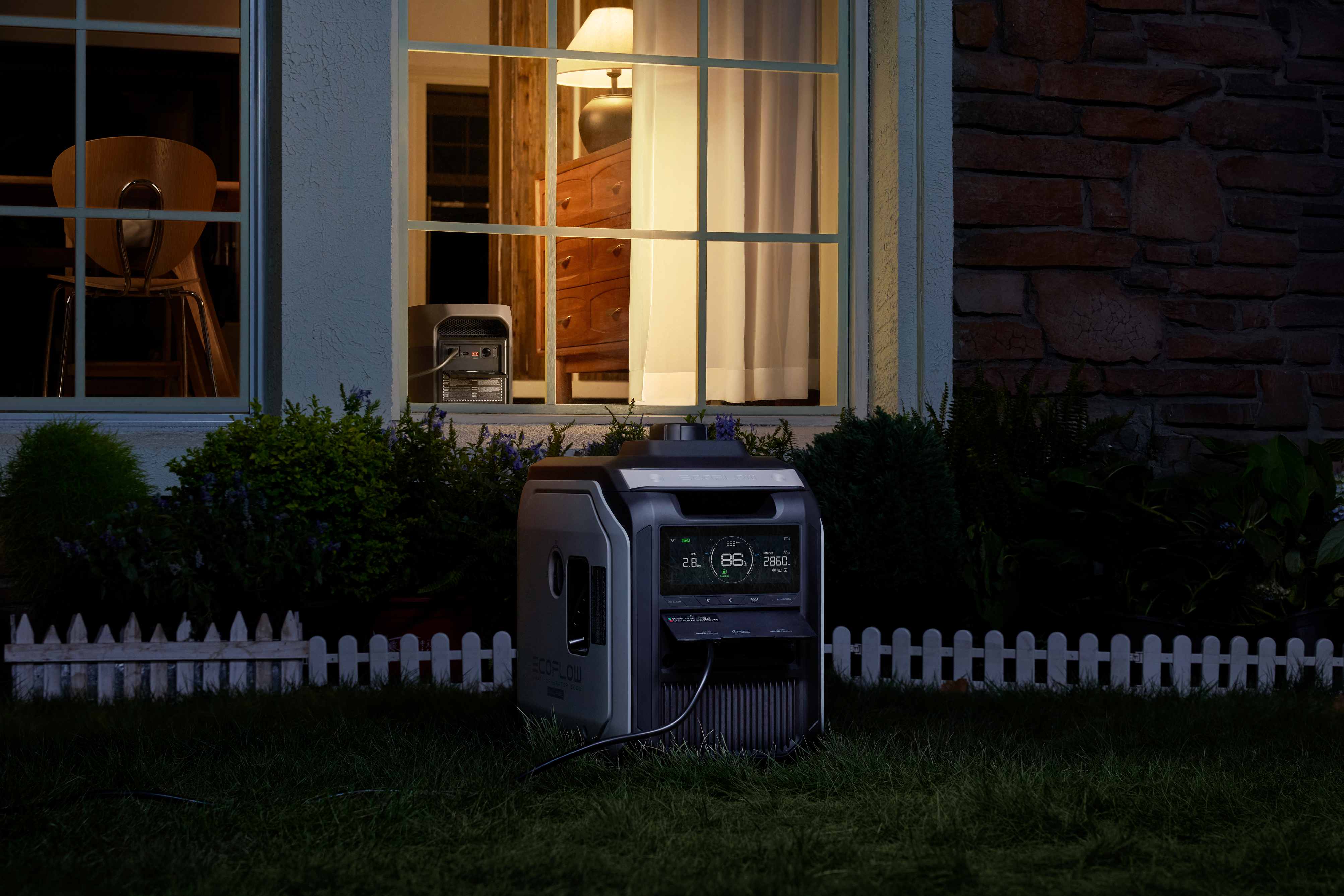
Get a Safe Power Source
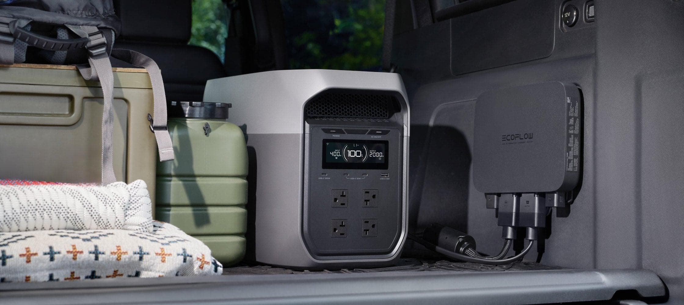
During freezes, rolling blackouts are common, which can shut down your furnace when you need it the most. Instead of using loud gas generators that produce a lot of fumes, think about a quiet indoor option like the EcoFlow DELTA 3 Max.
Run Essentials: It has a huge output (2400W) that can power high-wattage survival gear like electric space heaters and blankets, so your family can stay warm and safe indoors.
Quick Recharge for Blackout Cycles: Its quick charge (0–80% in around an hour) is very important for rolling blackouts. You can quickly charge the battery during short periods of grid restoration, making sure that you have power stored for the next outage.
Store Emergency Water
You can lose all of your water pressure if your pipes freeze or your city's pumps stop working because of a power outage.
Fill Your Bathtub: Clean your bathtub and fill it with water before the storm strikes. This gives you a huge backup supply of water in case of an emergency.
How to Use: Use a bucket to move this water to flush toilets by hand. In emergency situations, this water can be boiled or filtered so that it can be used for drinking and hygiene.
Long-Term Implications of Frequent Arctic Air Outbreaks
Climate scientists are studying whether the warming Arctic is really making these "wobbly" jet stream episodes happen more often. The strange thing is that as the Arctic warms up faster than the equator (a phenomenon called Arctic Amplification), the temperature differential that makes the jet stream stronger gets weaker. A weaker jet stream is more wavy, which could mean that arctic air moves south more often. This means that extreme cold events may become more frequent in winter.
Prepare for the Next Arctic Blast
Learning about arctic air and how the polar jet stream works will help you understand why winter can suddenly show up in the Deep South. We can't stop an arctic blast or change how the air moves, but we can change how we react to it. As the weather is increasingly unpredictable, it's important to go from passive hope to active preparation. Proper home winterization and a solid backup power source like the EcoFlow DELTA 3 Max can keep you safe and comfortable when the temperature drops.
FAQs on Polar Vortex & Arctic Air
Q1: What Is the Difference Between a Polar Vortex and an Arctic Blast?
The Polar Vortex is a huge, constant zone of low pressure and cold air that is always rotating at the poles. When that vortex expands or breaks up, it causes an Arctic blast that sends a mass of cold air south into the United States.
Q2: How Long Does an Arctic Air Outbreak Usually Last in the South?
In the south, these outbreaks are usually shorter than in the north. The intense cold generally lasts for two to four days before the jet stream moves north and warmer air from the Gulf of Mexico comes back in and moderates temperatures.
Q3: What States Will Be Affected by the Arctic Blast?
It depends on where the jet stream goes, but because of the way North America is shaped, states east of the Rocky Mountains are most likely to be affected. The West Coast is often protected by the Rockies, which form a wall. North Dakota, Minnesota, and Montana are the states that get hit the most often. During deep "meridional" flow events, however, cold air flows straight down the Great Plains, having a big impact on Texas, Oklahoma, Missouri, and Tennessee, whose infrastructure isn't as ready for sub-zero temperatures.
Q4: Where Is the Safest Place in the U.S. from Climate Change?
Studies on climate adaptability have found that places in the Pacific Northwest (like coastal Washington) and the Upper Midwest (like Michigan and Vermont) are often rated as "safer" places to live. Even though Arctic blasts still bring bitter cold to the Upper Midwest, severe storms, wildfires, and terrible droughts are less likely to happen there than in the South and West. These regions offer better long-term stability and protection from extreme heat events in the summer, though residents must still prepare for extreme cold in winter.
For press requests or interview opportunities, reach out to our media team
media.na@ecoflow.com