Best Scenic Drives Near Me: Fall Routes, Road Trips and Scenic Views
Fall colour in Canada doesn’t run on one clock. The larches go gold on the high slopes of Kananaskis first, Algonquin’s maples come a week or two behind, and the BC coast goes last, all of it sliding around with elevation and weather. That moving edge is what makes a scenic drive worth planning around. Get it right and you spend a day under maples the colour of a stop sign, windows down, with half the province out doing the same thing. Get it wrong by a week and you’re looking at bare branches. This guide covers the drives worth a weekend, when each one peaks, what to throw in the trunk, and weather that can turn on you in an afternoon.
What Are the Best Fall Scenic Drives in Canada?
There is no single best scenic drive for every traveller. Ontario combines hardwood forest and lakes, Alberta and British Columbia add mountain and coastal routes, and Atlantic Canada pairs highlands with ocean views. Choose by current conditions, available time, and the landscape you want to see.
| Region | Scenic Drive | Best Views |
|---|---|---|
| Ontario | Highway 60 through Algonquin Provincial Park | Sugar maple and yellow birch canopies reflected across calm lakes and rocky ridges |
| Alberta | Icefields Parkway (Highway 93N) | Golden subalpine larches against snow-dusted limestone peaks and turquoise glacial waters |
| British Columbia | Sea to Sky Highway (Highway 99) | Ocean vistas merging into coastal mountain peaks under evergreen and gold foliage |
| Atlantic Canada | Cabot Trail (Cape Breton, Nova Scotia) | Soaring coastal cliffs, Atlantic Ocean panoramas, and red-and-orange highland forests |
Explore Fall Colours in Ontario
Between late September and mid-October, central and northern Ontario can show gold, orange, and red at different times. Highway 60 crosses Algonquin Provincial Park, with roadside lakes and trail lookouts along the corridor. A maple road fall foliage route guide expands the trip into Muskoka, Killarney, the Ottawa Valley, and Quebec. Check current colour reports and reserve required park access before setting out.
Drive Through Mountain Scenery in Alberta
Few Canadian mountain routes match the scale of the Icefields Parkway (Highway 93N) between Lake Louise and Jasper. In late September, subalpine larches can turn yellow before dropping their needles, while nearby evergreens remain green. Around Bow Pass and Peyto Lake, the colour contrasts with turquoise water and early snow. Conditions and visibility vary, so check official road and weather updates before departure.
Follow Coastal and Mountain Routes in British Columbia
The Sea to Sky Highway (Highway 99) runs from Vancouver up the fjord-like shores of Howe Sound to Whistler. It takes you from saltwater and coastal forest into mountain valleys in about two hours, when the traffic behaves. Colour works differently here, because the evergreens never let go. Bigleaf maples, red alders and trembling aspens come at you in streaks of yellow through a forest that stays green all winter. On a wet day the whole valley drips. Pull into the Tantalus Viewpoint and you get glaciated ridges with autumn still clinging to the river valleys below.
Experience Autumn Views in Atlantic Canada
The Cabot Trail circles the northern tip of Cape Breton Island. There’s a case for it being one of the most dramatic drives in eastern North America. Ravines of orange birch, beech and maple fall away into the North Atlantic. The switchbacks up MacKenzie Mountain and French Mountain put you on what locals call a lookoff, where fog, cliffs and hillside all arrive at once. The fog keeps no schedule, and the moose come out on the plateau at dusk.
How Do You Choose a Scenic Drive Near You?
When comparing scenic drives near me, start with the time available, road conditions, vehicle suitability, and the stops that matter most. A guide on how to plan your road trip in Canada can help organize distance, timing, accommodation, packing, and backup options.
Start With Your Driving Distance
How long you are willing to drive shapes the trip. Short scenic drives can fit into a day from Toronto, Calgary, or Vancouver, while the Cabot Trail and the full Icefields Parkway benefit from more time. Build in stops for viewpoints, short walks, weather delays, and daylight rather than setting a schedule that requires rushing.
Plan Stops Along the Route
The pavement under your tires is the least interesting part of the day. Mark the pull-offs, the short trailhead loops, the farm markets and the visitor centres before you go, then stop. A climb up to a fire tower or a walk along a gorge breaks the day up and gets you out of the car long enough to feel the cold.
Choose a Route for Your Vehicle
Pavement and grade are the two questions that matter once you leave the main arteries. Most flagship scenic drives are well-maintained two-lane highways, and a standard sedan or compact crossover handles them without complaint. Gravel service roads and steep climbs to higher trailheads are another matter. There you want ground clearance, and tires that can deal with loose stone and the first frost.


What Should You Pack for a Canadian Fall Scenic Drive?
Canadian fall weather can change quickly, so pack for cold mornings, rain, and possible snow. For scenic drives with camping stops, a solar panel may provide an additional charging option when sunlight, site rules, and parking conditions allow.
Pack Layers for Changing Temperatures
A warm, sunny noon slides toward freezing the moment the sun goes behind a ridgeline, and on a pass it gets there while you’re driving. Breathable, moisture-wicking base layers, a fleece or wool mid-layer and a windproof, water-resistant shell see you through most roadside stops. Add a toque, light gloves and insulated boots to the trunk, because in October the morning starts with frost on the windshield.
Bring Food, Water and Emergency Supplies
Seasonal businesses and remote fuel stops may reduce their hours after summer, so carry food, drinking water, and a roadside emergency kit. A power station can support compatible electronics away from outlets, but it does not replace vehicle preparation, fuel planning, or emergency supplies.
Prepare Portable Power for Essential Devices
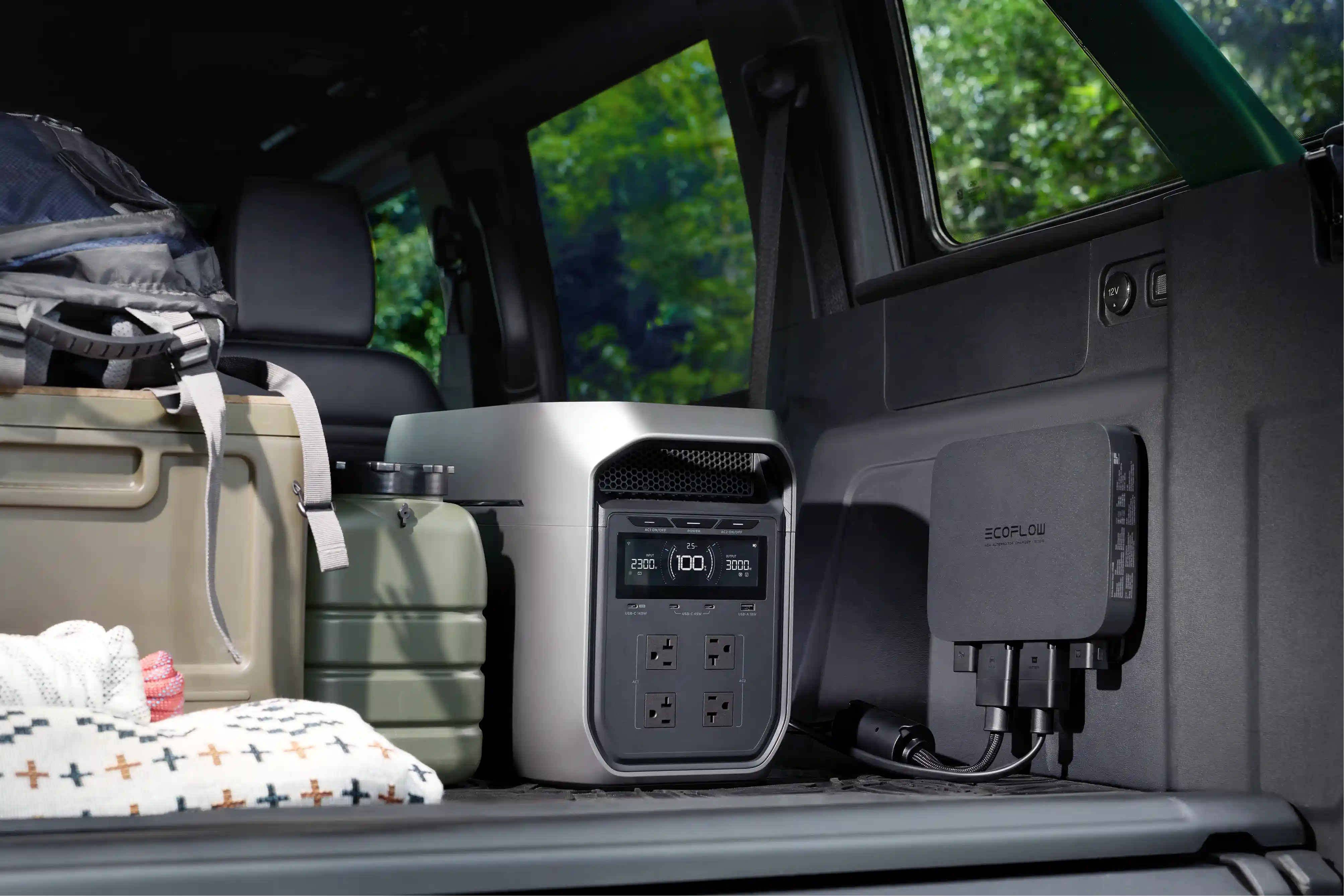
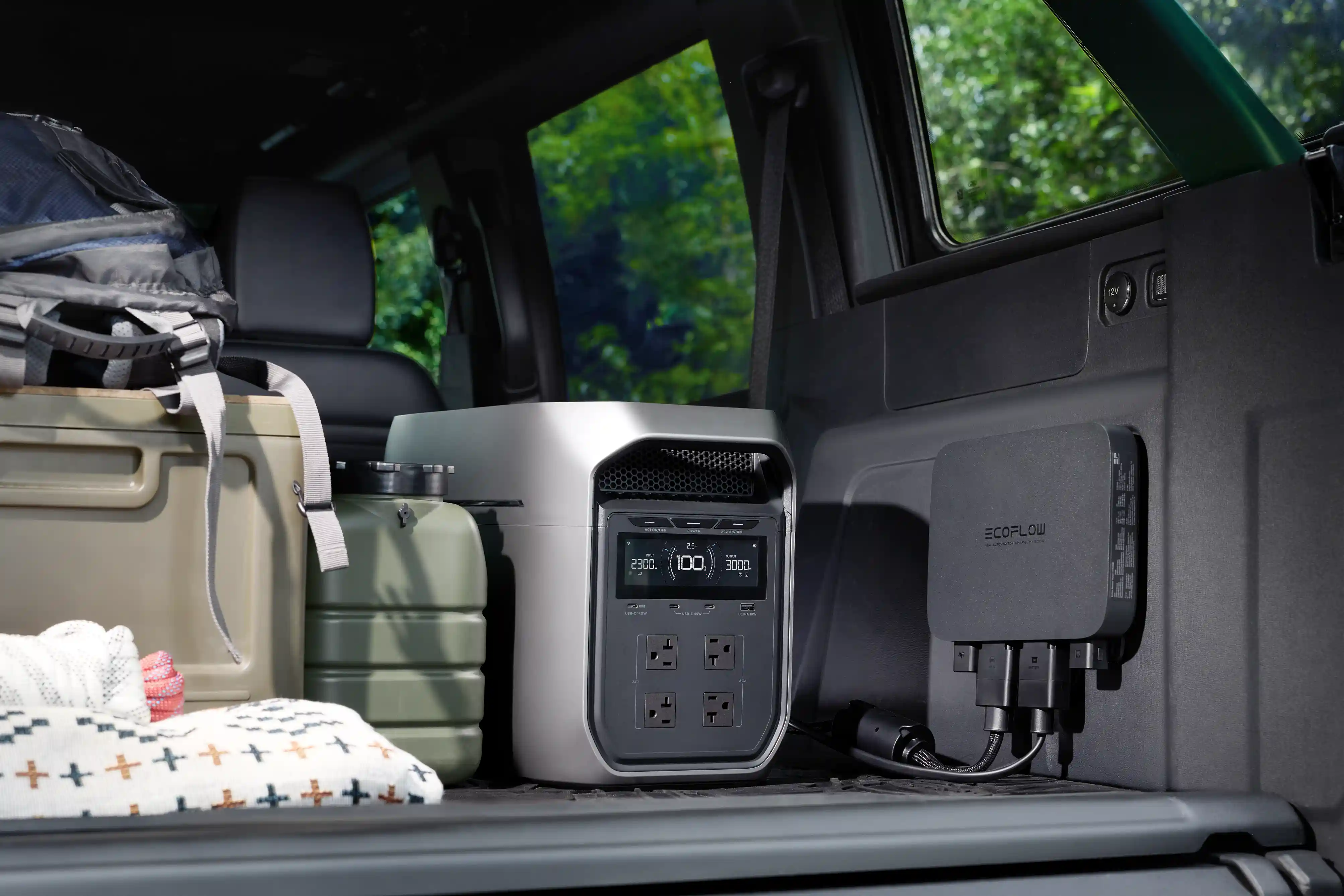
Phones, cameras, and small camping devices can run down during a fall drive, especially where pull-offs have no outlets. The EcoFlow DELTA 3 Classic Portable Power Station provides 1,024Wh of capacity for compatible road-trip electronics. Choose capacity and output from the devices you plan to run and the time needed between charging opportunities.
Pack Higher-Capacity Power for Longer Trips
When journeys extend across multiple days or include higher-draw camping equipment, the EcoFlow DELTA 3 Max Plus (2048Wh) + 800W Alternator Charger combines a 2,048Wh portable power station with vehicle-based charging. Actual charging performance depends on the vehicle, alternator, installation, driving conditions, and connected loads. Confirm compatibility and plan energy use before relying on it between remote stops.
When Is the Best Time for a Fall Scenic Drive in Canada?
Peak colour runs from late September into mid-October across most of the country, but the exact week depends on where you are and which trees you’re after. Ontario and Atlantic Canada, with their sugar maples and birches, stay close to that window. The Rockies run earlier and much tighter. The larches get two or three weeks from mid-September into early October, and then the needles are on the ground.
Check Local Fall Colour Conditions
Colour changes by latitude, elevation, species, and weather, so a report from two hours away may not match the route ahead. The Ontario Parks Fall Colour Report publishes current colour-change and leaf-fall percentages by park. Check the latest report close to departure, reserve any required day-use access, and leave room to adjust the route after wind or rain.
Plan Around Daylight Hours
Daylight disappears fast at Canadian latitudes between September and late October, and the window for driving and photography shrinks by the week. Plan to be off the winding, unfenced two-lane stretches by late afternoon. A highway with no lighting and no guardrail is a different road in the dark, and that’s also when the moose and deer are out.
Watch for Changing Weather
Fall weather in Canada can shift from mild sunshine to sleet or black ice in an afternoon, especially at higher elevations. Check provincial highway conditions and camera feeds before departure and confirm the rules for every province on your route. In British Columbia, winter tires or chains are required on most designated routes from October 1 to April 30, although some routes end March 31. Parks Canada requires snow tires marked with a snowflake or M+S symbol, or tire chains, on the Icefields Parkway from November 1 to March 31 and whenever the road is covered with snow or ice.
Conclusion
A Canadian fall road trip is easier to plan once you know the route, check current colour and road conditions, and prepare for cold weather and limited services. Download offline maps before you leave, plan your fuel and rest stops, and pack warm clothing, food, water and basic emergency supplies, so you are driving towards the colour rather than chasing it.
If you need portable power for phones, cameras, lighting or camping equipment, explore EcoFlow portable power stations and choose a model that matches your trip length and power needs.
FAQ
Can You Sleep Overnight at Rest Stops in Canada?
It depends on whose road you’re parked on. In Ontario, ONroute service centres generally limit parking to about four hours, enough for a nap to fight driver fatigue. In British Columbia, stays of more than 8 hours are discouraged and overnight camping isn’t permitted. Inside national parks (such as Banff, Jasper, or Cape Breton Highlands), the rule changes. Overnight parking or sleeping in a vehicle outside a registered campground is illegal, and the federal fines are heavy.
Do Scenic Drives in Canada Have Cell Service?
Not reliably. Coverage is often patchy on remote corridors and gone altogether on some: the Icefields Parkway, the northern sections of the Cabot Trail, and central portions of Highway 60. Download offline maps through Google Maps or your GPS app before you leave, and carry a satellite messenger on the isolated stretches.
Does It Cost Money to Drive the Cabot Trail?
Parks Canada requires a valid park entry pass when you stop or use facilities within Cape Breton Highlands National Park. Travellers driving along the Cabot Trail without stopping inside the park are exempt under the current notice. Check current admission rules and fees before departure.
How Long Does It Take to Drive the Icefields Parkway?
Driving the 232-kilometre Icefields Parkway straight through takes roughly 3 to 3.5 hours under clear driving conditions. In practice, factor in at least 6 to 8 hours, or a full-day itinerary. That covers the lower seasonal speed limits, the wildlife slowdowns, and the stops at Peyto Lake, Columbia Icefield and Sunwapta Falls.