10 Overlooked NOAA Tools That Are Surprisingly Powerful
- 1. nowCOAST: Your All-in-One Coastal Situational Map
- 2. HYSPLIT (READY online): Track Air Parcels and Plumes
- 3. HRRR/RAP-Smoke: High-Resolution Wildfire Smoke Forecasts
- 4. SWPC Aurora Tools: Time Your Aurora Hunt
- 5. NWS "Hourly Weather Graph": The 7-Day Planner's Secret
- 6. NDBC Buoys & Marine Stations: Real-Time "Ground Truth" on the Water
- 7. NOAA Tides & Currents: Plan Your Day and See the Future
- 8. Digital Coast | Sea Level Rise Viewer: 0–10 ft Inundation, Visualized
- 9. NCEI Storm Events Database: Know Your Area's Storm History
- 10. The 72-Hour Emergency Power Playbook
- Beyond the Daily Forecast
A wide variety of public data tools are available from the NOAA, the National Oceanic and Atmospheric Administration. A deeper look shows powerful, specialized platforms, even if many are familiar with the main forecast page. From coastal boaters and aurora chasers to emergency preppers, these hidden jewels give essential info. Here are 10 underappreciated NOAA tools you may use today.
1. nowCOAST: Your All-in-One Coastal Situational Map
For anyone who works or recreates on the water, juggling multiple maps for radar, wind, and marine alerts is inefficient. The nowCOAST map viewer solves this by acting as a powerful "all-in-one" dashboard for coastal situational awareness.
It is an interactive map service that allows you to stack dozens of different data layers. You can overlay the latest NOAA radar loop, recent satellite imagery, and real-time observations from buoys and coastal stations. On top of that, you can add forecast layers, such as 7-day wind, wave, and sea condition guidance. Finally, you can enable all active marine watches, warnings, and advisories. Seeing all these elements on one screen provides a complete operational picture. Boaters, divers, sailors, and even location scouts can quickly assess current and future conditions.
You can access the detailed local prediction by opening the map, adding the data you require from the layer menu, and then clicking on any coastline cell. Several levels are accessible via WMS/WMTS services that can be integrated into GIS software by advanced users.
2. HYSPLIT (READY online): Track Air Parcels and Plumes
Have you ever smelled smoke and wondered where it was coming from? Or do you need to know where a potential chemical release might travel? The HYSPLIT (Hybrid Single-Particle Lagrangian Integrated Trajectory) model is the professional tool for this, and its READY (Real-time Environmental Applications and Display System) webpage makes it accessible to the public.
This tool allows you to run two primary types of analysis. A "back-trajectory" calculates the path an air parcel took to arrive at a specific location, time, and altitude, effectively answering, "Where did this air come from?" A "forward-trajectory" does the opposite, predicting where an air parcel will travel from a starting point. You can also run a more complex "concentration" or "dispersion" model to see how a plume of material would spread and dilute over time. For more robust results, you can run an "ensemble," which calculates multiple trajectories with slight variations in the weather model to show the range of possibilities and your confidence in the track.
3. HRRR/RAP-Smoke: High-Resolution Wildfire Smoke Forecasts
During wildfire season, knowing where the smoke will be is critical for health and planning. The experimental HRRR-Smoke and RAP-Smoke models provide incredibly detailed, hour-by-hour smoke forecasts for the next 0-48 hours. This is essential for planning commutes, outdoor athletic events, or camping trips.
When using these maps, it is vital to distinguish between two key products. "Near-Surface" smoke is exactly what it sounds like—the smoke concentration at ground level where people breathe. "Vertically Integrated" or "Column-Integrated" smoke shows the total amount of smoke in the entire column of air above you, which is what affects sky color and visibility but may not impact your breathing. The practical way to use this tool is to load the near-surface forecast, step through the forecast hours, and identify the "peak" concentration times for your location. You can then plan outdoor activities around those windows.
4. SWPC Aurora Tools: Time Your Aurora Hunt
You no longer need to rely on vague guesses to see the Northern Lights. The Space Weather Prediction Center (SWPC) provides powerful tools for aurora chasers. The most important is the 30-Minute OVATION model, which provides a short-term forecast (30-90 minutes out) of the aurora oval's precise location and intensity.
This tool is best used in conjunction with the planetary Kp index. The Kp index (a number from 0 to 9) measures global geomagnetic activity; a higher number (Kp 5 or greater) means a stronger storm with a better chance of seeing the aurora further south. You can use the Kp index to know if a "chase" is worthwhile, and then use the 30-Minute OVATION forecast to time exactly when to head out and look north. The experimental Aurora Dashboard combines these elements into a single, easy-to-read display.
5. NWS "Hourly Weather Graph": The 7-Day Planner's Secret
This tool is hidden in plain sight on every local forecast page from the National Weather Service. When you check your nooa weather forecast, look for a link that says "Hourly Weather Graph" or a small chart icon. Clicking this reveals a comprehensive, 7-day, hour-by-hour chart of all critical weather variables.
Instead of just seeing "40% chance of rain," this graph shows you when that 40% chance occurs. It visualizes temperature, apparent temperature ("feels like"), wind speed and direction, precipitation probability, cloud cover, and sometimes even humidity on one timeline. This level of detail is invaluable for photographers planning a shoot, construction managers scheduling concrete pours, event coordinators, or even homeowners trying to time their home energy usage.
6. NDBC Buoys & Marine Stations: Real-Time "Ground Truth" on the Water
Weather models are forecasts, but buoys provide reality. The National Data Buoy Center (NDBC) maintains a network of buoys and coastal stations that provide a live, official reality check for marine conditions. This is non-negotiable data for surfers, divers, sailors, and anyone heading onto the water.
Using the all-stations map, you can find the buoy nearest your location. Its page will show you the latest wind speed, wind direction, wave height, wave period, and water temperature. You can compare this live "ground truth" data against the model guidance to see if the forecast is accurate before you launch your boat or paddle out. Many stations are even equipped with a "BuoyCAM" for a live visual, and all stations offer historical data for retrieval.
7. NOAA Tides & Currents: Plan Your Day and See the Future
This is another tool with a powerful, overlooked dual purpose. Most coastal users know the Tides & Currents site for its primary function: providing accurate tide predictions for any day. You can quickly find tomorrow's high and low tide times, which is essential for timing a fishing trip, planning coastal photography, or ensuring a safe launch window for a kayak.
The overlooked feature is on the same station page. Look for a link or tab labeled "Sea Level Trends." This will open a chart showing the multi-decade, measured relative sea-level trend for that exact location. This one tool allows you to frame both immediate plans (today's tide) and long-term risk (the multi-decade trend) at the same time, making it incredibly useful for coastal siting, risk assessment, and stakeholder communication.
8. Digital Coast | Sea Level Rise Viewer: 0–10 ft Inundation, Visualized
The Digital Coast's Sea Level Rise Viewer is a great way to see what would happen if water levels rose by X feet. This platform moves the abstract concept of sea-level rise into a tangible, local reality.
By entering any coastal city, users can easily visualize the possible flooding from zero to ten feet of water using a minimalist slider. To visualize the precise area that will be affected, you can combine satellite data with important landmarks such as hospitals, highways, or parks. Stakeholders, municipal planners, and park managers can all benefit greatly from this "what if" storyboarding when it comes to communicating risk. Screenshots may be exported with ease for use in proposals or community meetings. The program also provides "Local Scenarios" that are based on localized climate projections for more in-depth examination.
9. NCEI Storm Events Database: Know Your Area's Storm History
Before moving to a new area or siting an expensive warehouse, you should know the local "temperament." The NCEI Storm Events Database is the official, searchable record of severe and flood-related weather events in the UnitedSstates, with some records going back to 1950.
This tool allows you to fact-check the local history. You can filter by county, a specific date range, and event type. Are you curious about the history of damaging hail, tornadoes, or high-wind events? This database will give you a list of every documented event, often with details on damage and magnitude. It is the definitive source for insurance and risk assessment, journalism fact-checks, and understanding the seasonality of local threats, including the impacts of a previous nooa hurricane. You can even export the results as a CSV for your own analysis.
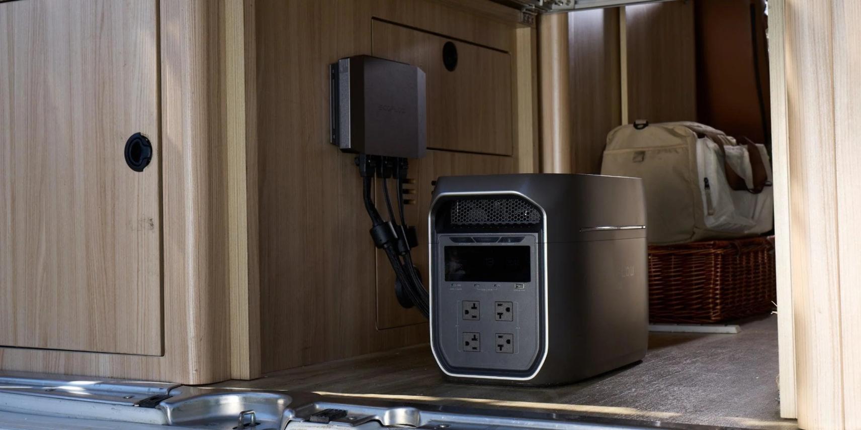
10. The 72-Hour Emergency Power Playbook
This isn't a single tool, but a strategy for households and small businesses to prepare for weather-related power outages. You may manage your emergency gear and portable power source with this playbook that incorporates three NOAA tools.
Step 1 (3–7 Days Out): The WPC Hazards Outlook
This early warning is derived from the WPC 3-7 Day Hazards Outlook. This map shows large regions that may experience extreme weather conditions. When your location is highlighted, the "T-72 hour" indicator will be shown. Get your portable power source and batteries charged up. Perform a "load rehearsal" by connecting your phone, radio, and router to ensure they are all functioning properly. Make sure that a large battery, like a Delta 3 Max (2048Wh), is fully charged right these moments.

Step 2 (1–3 Days Out): The National Water Prediction Service
National Water Prediction Service updates will be provided as the event approaches. Forecasts of river stages and flood risks for neighboring gauges are displayed on this map. There is a greater likelihood of a protracted, flood-related power loss if the WPC has indicated significant rain and your local rivers are expected to rise. If you're thinking about upgrading your power station with solar panels or putting more emphasis on communication equipment, this might influence your decision.
Step 3 (Calibration): The Storm Events Database
Finally, use the NCEI Storm Events Database (Tool 9) to calibrate your expectations. Pull the last 10–20 years of wind, ice, or nooa hurricane events for your county. Are outages typically a few hours, or do they last for days? This historical context helps you "right-size" your battery. A small, 500Wh unit may be fine for an area with brief outages. However, for a region with a history of multi-day recovery times, a high-capacity unit like the Delta 3 Max (2048Wh) provides over 2kWh of energy, making it much more appropriate for running essential loads like radios, and a router for several days.
This playbook gives you a simple day/night schedule for an outage:
Daytime: Use solar panels (if you have them) to recharge the power station. Run essential loads like a modem or handheld radios for updates.
Nighttime: Conserve power. Run only the absolute essentials, such as a critical medical device, a small LED light, or brief phone charges.
Beyond the Daily Forecast
Beyond the five-day prediction, NOAA's data universe stretches far and wide. You may improve your planning, decision-making, and understanding with the help of these strong, specialized tools. Whether you're on the ocean or in your own backyard, these platforms provide an expert-level view of the environmental forces at work. These overlooked resources are waiting for you to discover them.
For press requests or interview opportunities, reach out to our media team
media.na@ecoflow.com