Quezon City Flood Guide: Risk Areas, Maps, Alerts & Official Updates
A sudden Quezon City flood can disrupt roads, homes, and travel within a short time during heavy rain. On 30 August 2025, PAGASA’s Science Garden station in Quezon City recorded 134.2 mm of rain between 1:00 PM and 4:00 PM, showing how much rain can fall within only a few hours.
This guide explains where to check official flood, weather, and road updates, how to assess risk around your barangay and regular routes, and how to prepare essential supplies and backup power before severe weather arrives.
Key Takeaways
Flood risk varies across Quezon City, so check your home, parking area, and regular routes before severe weather arrives.
For travel decisions, current road and rainfall conditions matter more than long-term hazard maps. Check the latest official advisories before heading out during heavy rain.
Prepare early and avoid flooded roads. Keep your Go Bag ready and follow local evacuation instructions when conditions worsen.
Plan for possible power outages. An EcoFlow portable power station can keep essential devices running when grid power goes down.
Where to Check Quezon City Flood Updates Today
Flood and road conditions can change quickly during heavy rain, so check the latest timestamped information before you travel. These official sources serve different purposes when you need a Quezon City flood update:
QC iRISE-UP: Check real-time disaster-monitoring data and local weather conditions from Quezon City’s monitoring system.
Quezon City DRRMO: Check the notices for active road closures, flood depths, and safe evacuation instructions.
PAGASA: Check Heavy Rainfall Warnings, Thunderstorm Advisories, NCR forecasts, and Metro Manila flood monitoring before traveling during severe weather.
Meralco: If severe weather also causes a power outage or brownout, check Meralco's Official Outage Map & Report Portal for outage status and estimated restoration information for your address.
Always check when an advisory was posted, since road conditions may change as rainfall continues. Understanding how PAGASA rainfall warnings indicate increasing rainfall risk can also help you assess conditions before traveling.
Quezon City Flood-Prone Areas and Flood Map
Flood risk can vary from one street to another across Quezon City. A Quezon City flood map can help you understand long-term flood susceptibility around your home, workplace, parking area, and regular routes.
How to Check Flood Risk with HazardHunterPH
HazardHunterPH can help you review flood susceptibility for a specific location. It uses hazard information generated by Philippine government agencies and is most useful as a planning reference rather than a substitute for current flood and rainfall advisories.
Check a Specific Location: Search your home, workplace, parking area, or another regular destination.
Review Flood Susceptibility: Check the flood assessment for that location and note the reported hazard level.
Compare Nearby Routes: Use the map as one planning reference, then confirm evacuation routes and evacuation-center locations with your barangay officials or QCDRRMO. Quezon City also maintains an official list of barangay evacuation facilities.
Which Quezon City Areas Need Closer Attention?
Some barangays and streets appear more often in Quezon City flood, road, or evacuation updates during heavy rain. If you live or work in these flood-prone areas in Quezon City, you must pay extra attention to local weather alerts.
Barangay / Area | What to Check During Heavy Rain |
Doña Imelda | Check current street-level road advisories and evacuation updates. |
Talayan | Check current rainfall, road conditions, and barangay evacuation notices. |
Damayang Lagi | Check the latest timestamped road status before traveling. |
Roxas | Check current local flood and evacuation advisories. |
Flood exposure can still vary within the same barangay because elevation, drainage, and nearby waterways differ from one street to another. A property on slightly higher ground may remain dry even when a nearby road floods. Check your specific location on the hazard map, then review current road and weather updates before traveling during heavy rain.
Why Does Quezon City Flood So Quickly?
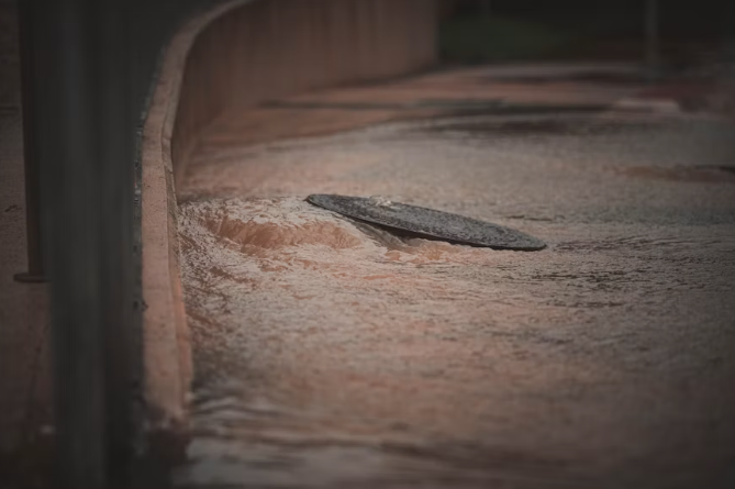
Flooding in Quezon City can develop quickly when intense rainfall, extensive paved surfaces, and local waterways place pressure on the drainage system at the same time.
Intense Short-Duration Rainfall
Habagat, tropical cyclones, and localized thunderstorms can bring large amounts of rain across Metro Manila. The duration of a storm matters, but rainfall intensity can also cause flooding when a large volume falls over a short period:
Intense Localized Downpours: Strong thunderstorms can concentrate heavy rainfall over a relatively small area, so conditions may vary across different parts of the city.
Prolonged Monsoon Rain: Repeated rainfall can keep waterways and drainage channels under sustained pressure, leaving less capacity to handle another heavy burst.
Rapid Runoff: Short, high-volume downpours can send water into streets, drains, and creeks faster than local drainage can move it away.
Dense Urban Surfaces and Drainage Capacity
Quezon City contains large areas of roads, roofs, commercial developments, parking spaces, and other paved surfaces. These surfaces reduce the amount of rain that can soak into exposed ground and direct more runoff toward drains and waterways.
Urban Factor | How It Can Increase Flood Risk |
Impervious Surfaces | Roads, roofs, and parking areas direct rainfall into surface runoff, increasing the volume that drains and waterways must handle. |
Drainage Capacity | Intense runoff can exceed the capacity of individual drains, canals, or low-lying sections of the network during peak rainfall. |
Blocked Waterways and Drains | Garbage, silt, debris, and other obstructions can restrict water flow and contribute to localized street flooding. |
Rivers, Creeks, and Local Topography
Local terrain and waterways also influence where floodwater collects and how quickly it drains. Quezon City includes low-lying communities as well as numerous rivers and creeks.
Low-Lying Areas: Water naturally collects at lower elevations, particularly where runoff arrives from surrounding higher ground.
Rivers and Creeks: Higher water levels can reduce how quickly nearby drainage channels discharge runoff and can increase flood exposure along vulnerable sections of waterways.
Local Drainage Constraints: Narrow channels, obstructions, and poorly positioned infrastructure can restrict water movement. Quezon City has documented cases where structures along creeks interfered with normal flow and worsened local flooding.
What to Do Before, During, and After a Quezon City Flood
Flood preparation becomes harder once roads start flooding. Complete the main household, evacuation, and communication steps before conditions deteriorate:
Before a Flood: Prepare Your Home and Evacuation Plan
Start preparing when PAGASA or Quezon City officials issue warnings for severe weather or possible flooding. Focus on the practical steps you may not have time to complete once water starts rising.
Review current conditions: Check the latest official flood, weather, and road advisories before making travel or evacuation decisions.
Plan your evacuation: Identify more than one route to higher ground or your designated evacuation center, especially if your usual route includes low-lying roads or underpasses.
Prepare your Go Bag: A well-stocked flood Go Bag, including IDs, cash, essential medicines, drinking water, a flashlight, chargers, and other basic supplies.
Protect important belongings: Move documents, electronics, chemicals, and other essential items above likely flood level.
Move vehicles early: Relocate cars or motorcycles from basement parking and other low-lying areas if flood risk increases.
Set a family contact plan: Agree on an emergency contact and meeting point in case household members become separated.
During a Flood: Stay Safe at Home and on the Road
Once flooding begins, follow current local instructions and avoid making travel decisions based only on how shallow the water looks. If authorities advise evacuation, leave as early as conditions safely allow.
If You Are at Home
Move to higher ground: Keep family members and pets away from rising water and move upstairs or to a safer elevated area when necessary.
Handle electricity carefully: Turn off the main breaker only if you can reach it safely from a dry location. Do not touch electrical equipment near floodwater.
Keep essentials with you: Take your Go Bag, medicines, phone, and important documents if you need to move or evacuate.
Follow evacuation instructions: Go to the designated evacuation center when local authorities tell residents to leave.
Call for emergency help: Dial QC Helpline 122 if you need rescue or urgent assistance, and provide your location or a clear nearby landmark.
If You Are on the Road
Avoid flooded roads: Do not walk or drive through floodwater, even when it appears shallow.
Turn around early: Choose another route when water blocks the road or officials restrict access.
Stay clear of electrical hazards: Avoid fallen power lines, submerged electrical equipment, and damaged street infrastructure.
Move toward higher ground: If conditions worsen and you cannot continue safely, stop traveling and move to a safer elevated location.
After a Flood: Return, Clean Up, and Restore Power Safely
Do not assume an area is safe as soon as the water recedes. Wait for local authorities to confirm that you can return, then check your home carefully before beginning cleanup or restoring electricity.
Avoid contaminated water and mud: Wear boots and gloves during cleanup and wash exposed skin with soap and clean water after contact with floodwater.
Check electrical systems first: Have wet wiring, outlets, or electrical equipment inspected before restoring household power.
Discard contaminated food: Throw away food or drinking water that came into contact with floodwater.
Clean affected surfaces: Wash and disinfect floors, walls, and other areas exposed to contaminated water.
Document property damage: Take clear photos of damaged rooms and belongings before cleanup when it is safe to do so.
Watch for health symptoms: Seek medical advice after significant floodwater exposure, particularly if you have cuts or wounds or later develop symptoms such as fever, headache, muscle pain, vomiting, red eyes, diarrhea, or yellowing of the skin.
Backup Power During Flood-Related Outages
Severe storms and flooding can increase the risk of a power outage, or brownout as it is commonly called in the Philippines, sometimes at the same time that households rely most on phones, internet access, lighting, and refrigeration. A backup power plan can help you stay connected to weather and evacuation updates and keep essential household devices available during an outage. Before severe weather arrives, charge your backup system fully and place it in a dry, elevated area away from possible floodwater.
For shorter outages and essential loads, the EcoFlow DELTA 3 Classic Portable Power Station can support devices such as phones, a Wi-Fi router, and lighting. Its OASIS 3.0 Storm Guard Mode can help prepare the unit for incoming severe weather, which makes it useful when conditions may change quickly.
Longer outages can create different priorities. You may need to keep a refrigerator running, charge several devices across the household, or support other essential appliances for an extended period. It helps to decide in advance which devices matter most and manage available battery power around those priorities. Keep all electrical equipment dry, and only reconnect appliances once the surrounding area and household wiring remain safe.
For households that need broader backup during a longer outage, the EcoFlow DELTA 3 Max Portable Power Station provides higher capacity and rated output for households with larger essential loads. Its extreme environment resistance also suits humid storm-season conditions, with a reinforced structure that helps protect the system from moisture and condensation.
Conclusion
A Quezon City flood can affect streets differently from one storm to the next, so current information matters as much as long-term risk planning. Check official weather and road updates before traveling, know your evacuation options, and prepare a typhoon emergency kit and essential supplies before severe rain arrives. A clear household plan and reliable backup for communication can make it easier to respond when flooding or power outages disrupt normal routines.
FAQs
How can I check a property’s flood history in Quezon City before buying or renting?
Start with HazardHunterPH to check the property’s long-term flood susceptibility, then review past Quezon City road and flood advisories for the surrounding streets. Ask the landlord, building administrator, or longtime residents whether water has entered the property, basement parking, or nearby access roads during major storms. It also helps to visit after heavy rain, since drainage problems and low-lying sections may not be obvious during dry weather.
Does living in a flood-prone barangay mean my home will always flood?
Not necessarily. Your whole barangay might carry a high-risk label, but your exact street could sit on a slight hill. Flooding in Quezon City depends on your home's elevation, clogged street drains, and local creek walls. Type your address into HazardHunterPH to find indicative flood susceptibility. Even if your driveway usually stays dry, always pack an emergency bag just in case.
What immediate health steps should I take if I wade through Quezon City floodwaters?
Wash your legs and feet with clean water and soap immediately. Urban floodwater is a dangerous mix of mud, trash, and raw sewage. Change out of wet clothes right away. If you have any small cuts on your skin, visit a local health center quickly. The dirty stormwater spreads deadly leptospirosis, so never ignore a sudden fever.